

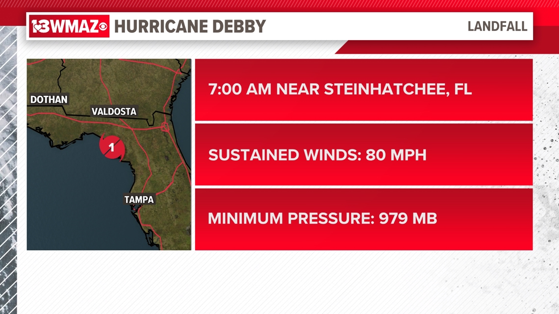
MACON, Ga. — Debby made landfall as a Category 1 hurricane in the Big Bend area of Florida Monday morning, and outer bands of showers are continuing to dump rain in our east and southeastern counties as it slowly moves over the Savannah area.

Debby made landfall near Steinhatchee, Florida around 7 a.m. on Monday morning. From that point on, it continued to weaken as it moved over land. Debby maintains tropical storm status as of now with sustained winds of 45 mph and gusts even higher, a central low-pressure of 998 MB, and is moving northeast at 7 mph.

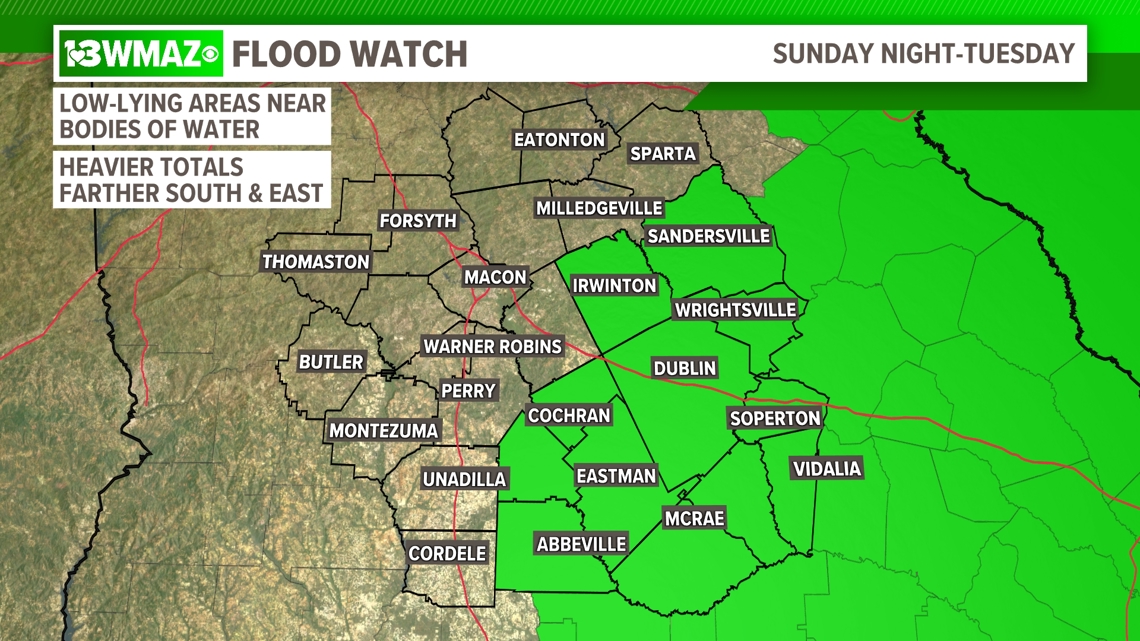
The main concern continues to be flooding for areas that saw almost non-stop rain yesterday. Heavy rainfall accumulates the further you go down I-16.
The National Weather Service has issued a flood watch that started Sunday evening and goes all the way until tonight for the southeastern half of Central Georgia. Some counties originally included have been trimmed off.
Low-lying areas near bodies of water are going to be most prone to flooding.

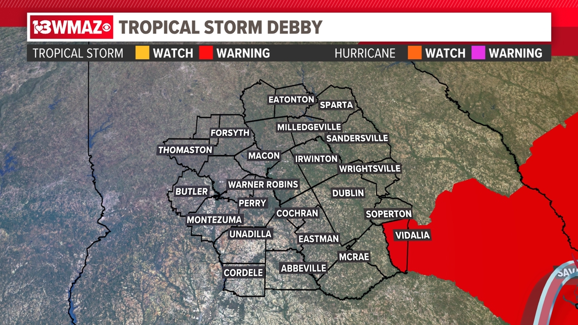
Tropical Storm Watches and Warnings
A Tropical Storm warning has been trimmed down to just Montgomery county..
This means winds can range from 39 to 74 mph within the next 36 hours. However, this would only be occasional gusts, not sustained winds, and they look to be on the lower end of the range with gusts as high as 40-45 mph at the most.

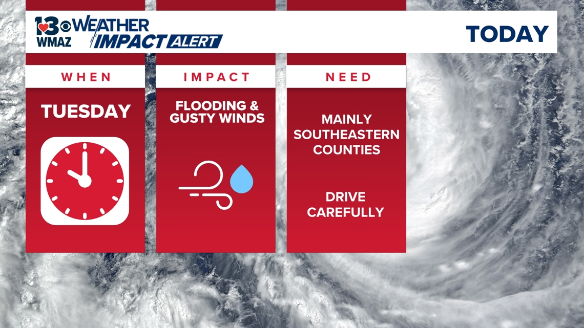
Because of the impacts we are experiencing from Debby, we continue with our Weather Impact Alert day for Tuesday.
However, the storm is expected to impact Central Georgia through the left side, which is the calmer side. Flooding will be our main concern here in Central Georgia, though we could also see some damaging wind gusts, up to 35 to 40 miles per hour. A Weather Impact Alert continues for Tuesday while this storm is forecasted to linger near Central Georgia.

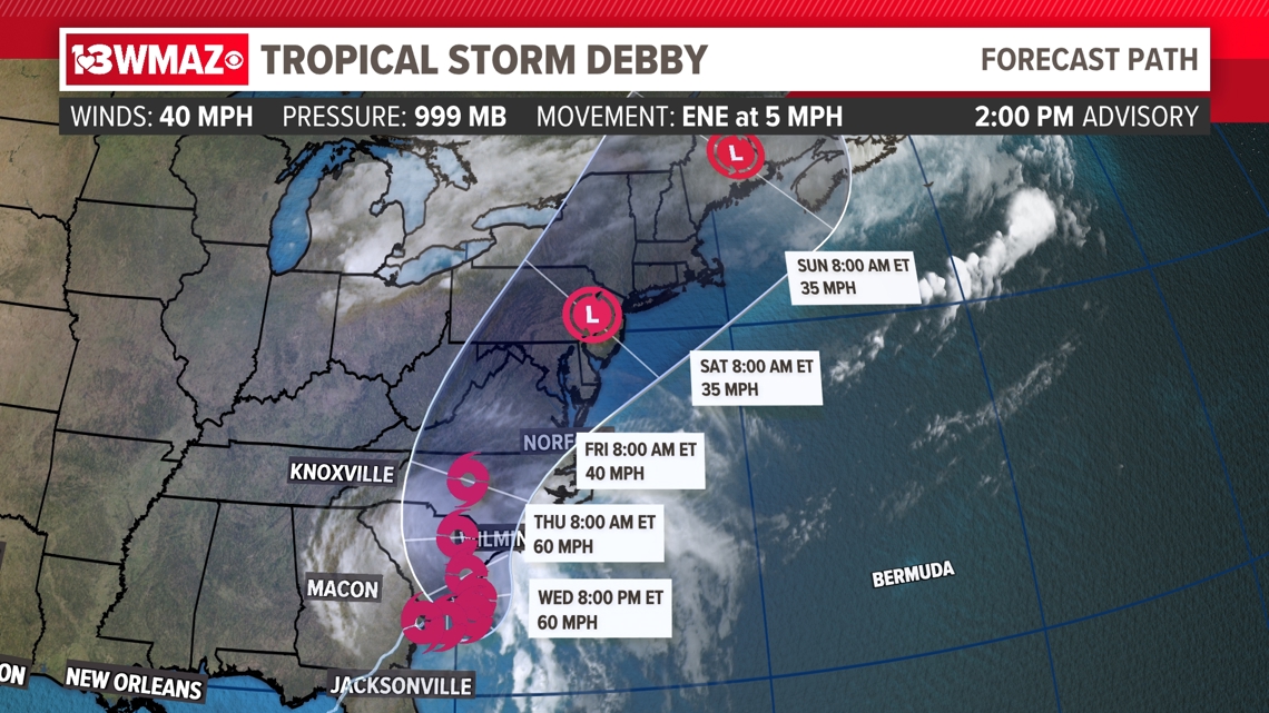
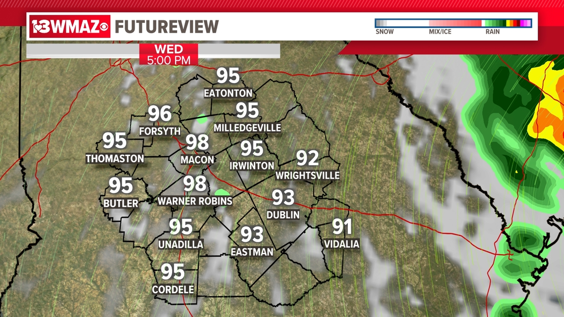
We're beginning to see a little more certainty with Debby's track past Tuesday. Wednesday looks to be a mostly dry and hot day with a small isolated sprinkle chance beyond outer bands of rain, but overnight into Thursday it looks like some steadier rain returns as Debby moves back out to sea to our east and regains some intensity over the Atlantic ocean.

The GFS is still confident that we will see a re-entry of Debby here in Central Georgia, but more confidence remains with the EURO model that Debby will continue up to the northeast.
If the GFS scenario is to play out, Weather Impact Alert Days may need to be extended into Thursday and beyond, but as of now, the consensus remains that Debby will continue northeast of us.

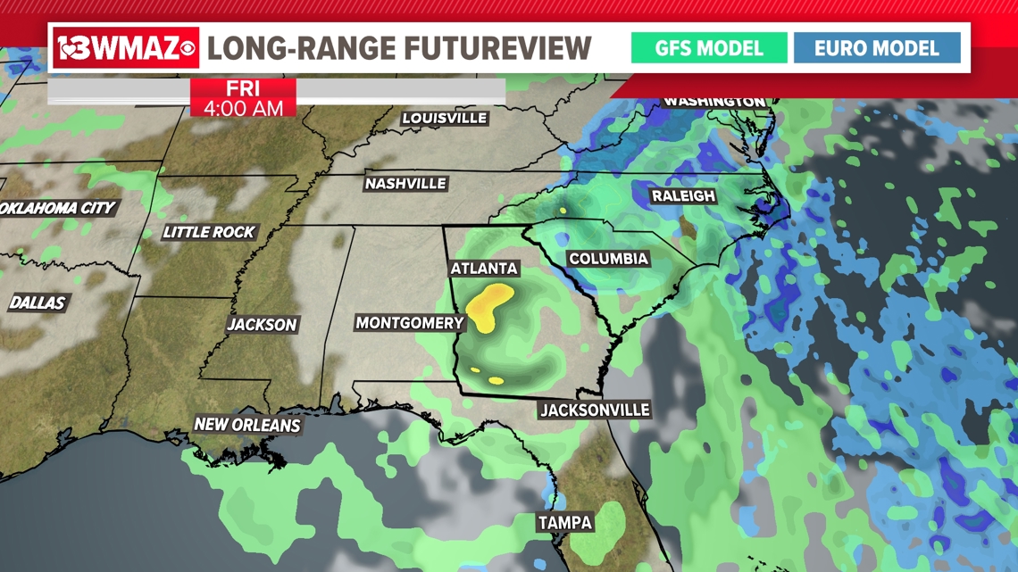
As uncertainty grows in the long range, our 13WMAZ Weather Team will continue to monitor changes in the storm's movements and update you on the latest in its expected track.