
MACON, Ga. — The 13WMAZ weather team is continuing a Weather Impact Alert for Tuesday, as Tropical Storm Debby continues to bring rain and gusty winds to central Georgia.
Debby made landfall as a Category 1 hurricane in the Big Bend area of Florida, and outer bands of showers are continuing to dump rain on the eastern half of central Georgia.
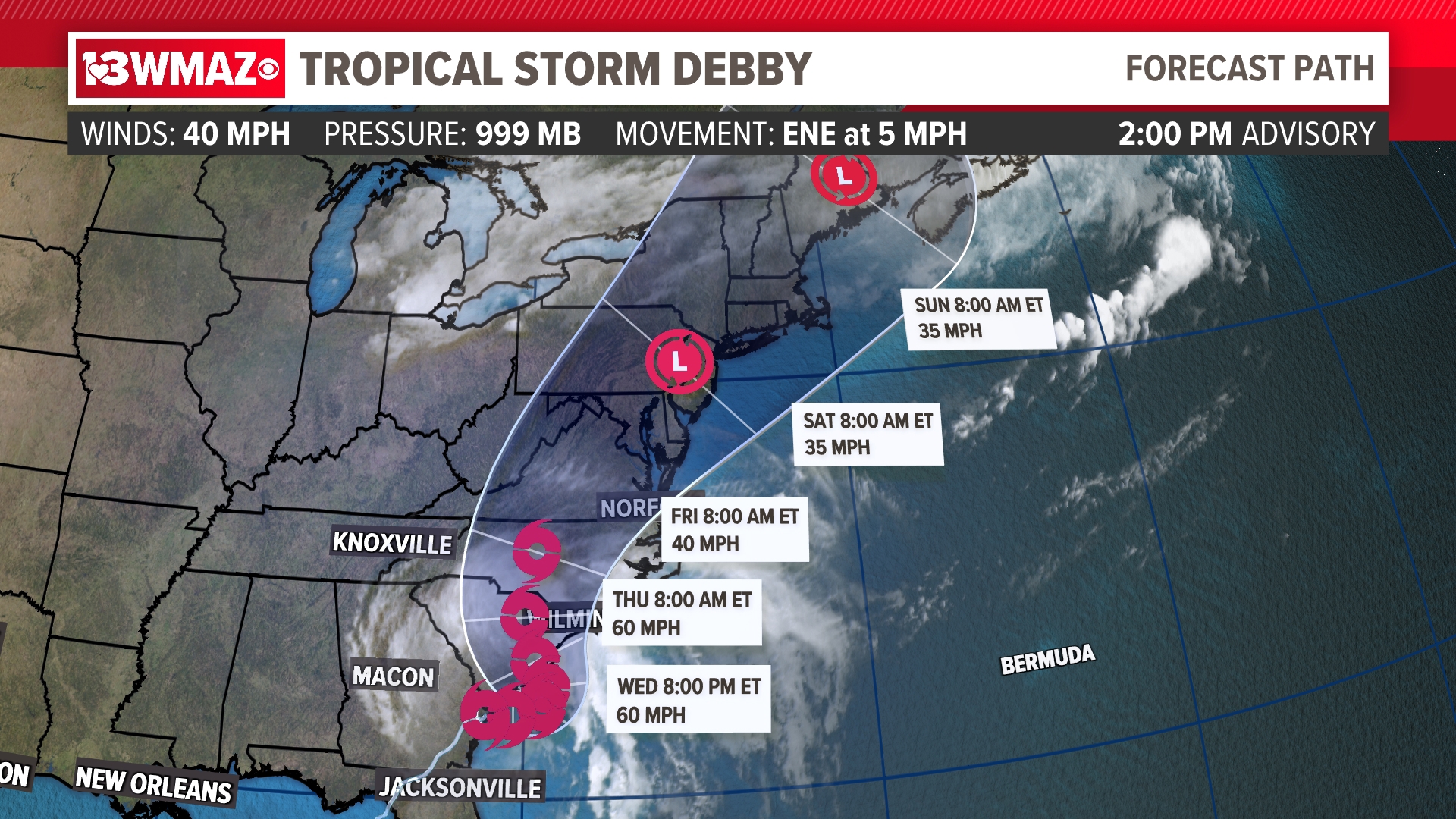
Debby went back down to tropical storm status as of Monday's 11 a.m. advisory from the National Hurricane Center. As of the Tuesday 11 a.m. update, it has sustained winds of 40 mph, a central low-pressure of 999 MB, and is moving very slow to the east-northeast at 6 mph.
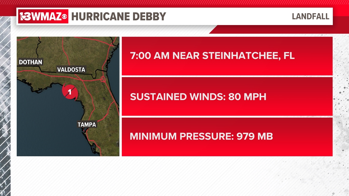
Around 7 a.m. Monday morning, Debby made landfall as a Category 1 hurricane near Steinhatchee, Florida. It sustained winds of 80 mph, a central low-pressure of 979 MB, and moved north-northeast at 10 mph.

Debby makes landfall just 20 miles away from where Hurricane Idalia did less than a year ago, making the second landfall of a hurricane the Big Bend area has seen within the last year.

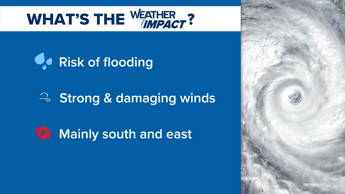
The main concerns for central Georgia still remain flooding in counties in our southeast corner that receive heavy rainfall totals along with gusty winds up to 40-45 mph at times. These are outlined in our Weather Impact graphics below.
How Debby could impact Central Georgia:
Debby continues to make slow progress through southeast Georgia towards the Atlantic ocean.
This slow movement continues to bring outer bands of rain to central Georgia. A few Flash Flood Warnings were issued last night, and one still continues for Treutlen, Laurens, and Johnson counties.
Wednesday is trending mostly dry as Debby continues to move east. As it attempts to reorganize a bit moving over the warm Atlantic waters, we could see some more rain from outer bands overnight into Thursday.


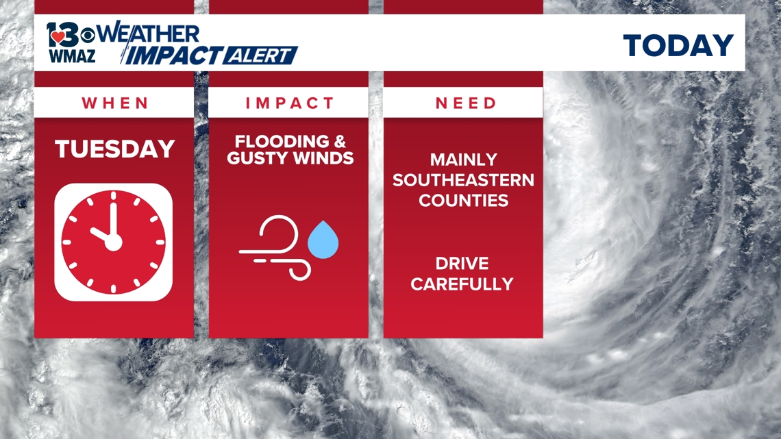
The Weather Impact Alert days will continue into Tuesday. Note that the times are subject to change as the specific timing of these impacts is uncertain.
The prolonged rainfall will continue to have an impact on the Eastern and Southeastern counties, increasing the chances of flooding.
Heavy rainfall could be present at times, limiting visibility on the roadways. If you see a potentially flooded road, it is best to turn around and avoid it at all costs.
Flooded roads have the tendency to seem more shallow; however, they are typically deeper than they look. It takes six inches of water to cause your car to stall and lose control and a foot to make it float.

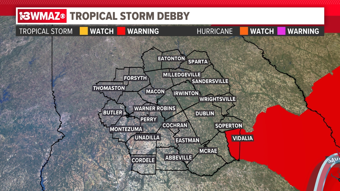
The southern and eastern counties will experience gusty winds. A Tropical Storm Warning has been trimmed down to just Montgomery county now. Wind gusts are expected to surpass 39 miles per hour here in the next 36 hours, but we do look to see wind gusts on the lower end of this range.
Some school districts in Central Georgia have announced they will close their doors, or push back their opening day, because of the potential impacts of Debby. You can find more on those schools here.

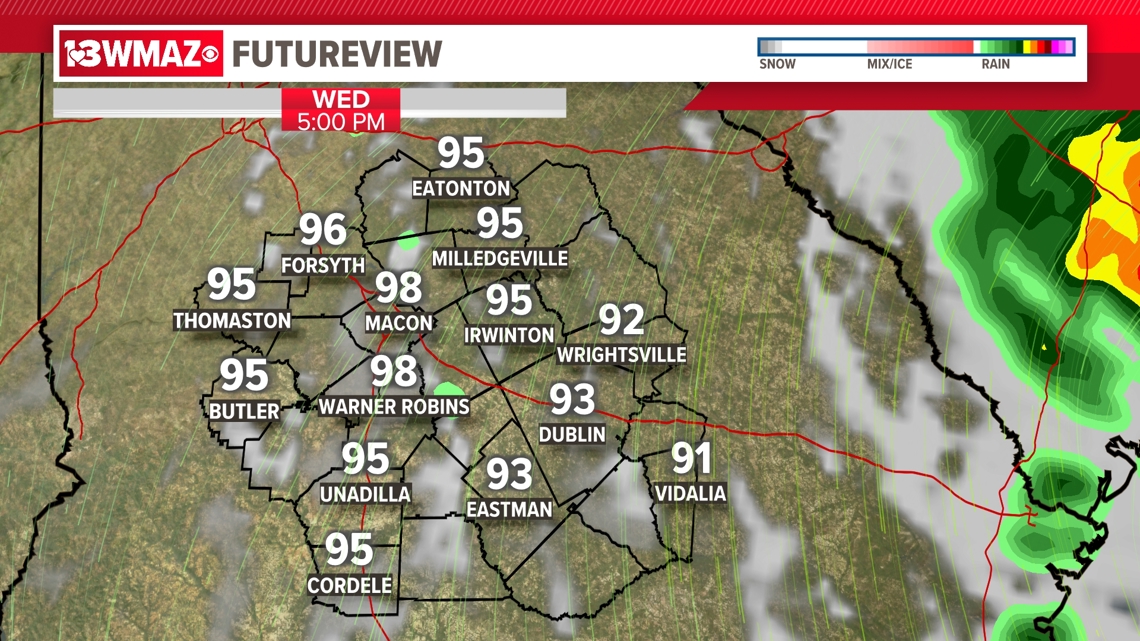
After a day full of rain for our eastern and southeastern counties, there's still more to fall as we go through Tuesday.
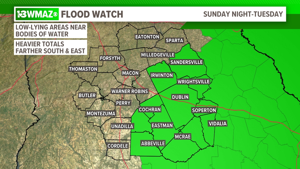
Our main threat with this system is still the risk of flooding, mainly in our southeastern half. With this, the National Weather Service has issued a flood watch for the counties outlined in the graphic below which started Sunday evening, and will continue all the way through Tuesday. Low-lying areas near bodies of water like creeks, streams, ponds, and rivers will be more prone to flooding than others, but all counties outlined in the green need to be prepared for a flooding risk for heavy rainfall accumulation.

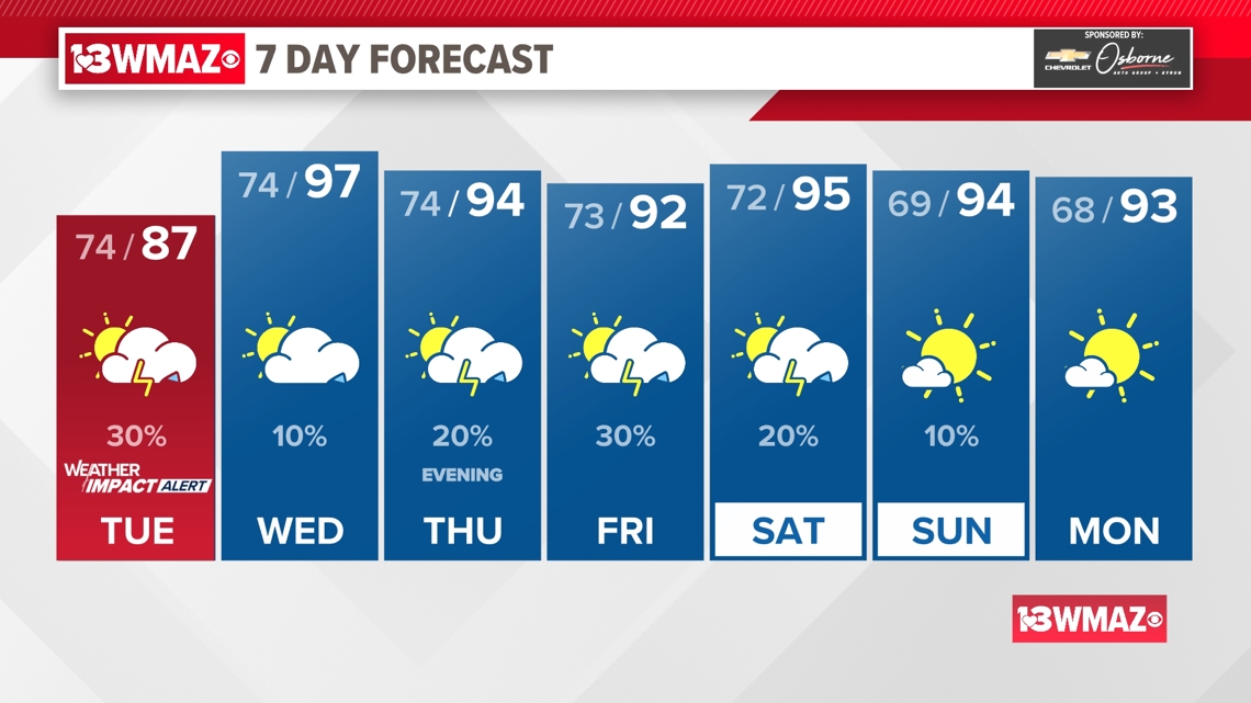
Because of the impacts we are experiencing from Debby, we continue with our Weather Impact Alert for Tuesday.
The track of the system past Tuesday is becoming a little more certain, but we could once again see impacts from Debby in the later part of the week. It will depend on whether or not this storm tracks its way back towards the west. We will continue to watch the movement of this system and provide you updates as we receive them.

Throughout the Weather Impact Alert Days, it is best to stay weather-aware and watch for more updates to the forecast or potential alerts from the National Weather Service. We'll keep you up to date on air and online as the storm continues to move.