
MACON, Ga. — Hurricane Debby is set to make landfall as a Category 1 hurricane over the Big Bend area of Florida in the morning hours on Monday.
While Central Georgia is not forecasted to see the most severe impacts, there is still a flood risk in our southeastern counties along with gusty and damaging winds in the forecast. That's why 13WMAZ has issued a Weather Impact Alert for Monday and Tuesday.
Stay up to date with Debby with a look at our live radar here:
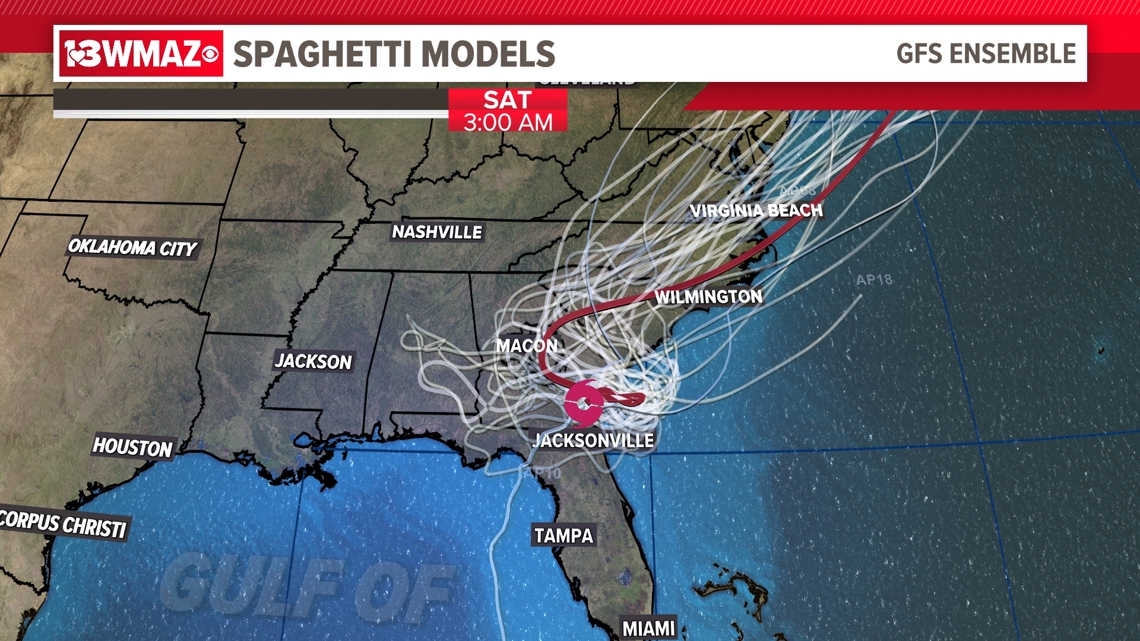
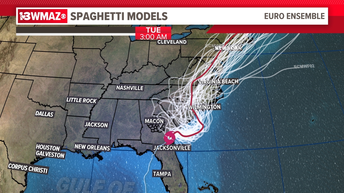
Hurricane Debby spaghetti models
Each line represents a different computer model run of Debby's forecasted path.
Below, you will see the GFS and EURO model runs highlighted by the red line of each model's best guess of Debby's path throughout the end of the week.
It is worth noting that this line does not outline impacted areas, it merely shows the path the center of circulation will take according to the latest data collected.
Here are the spaghetti models for Hurricane Debby:


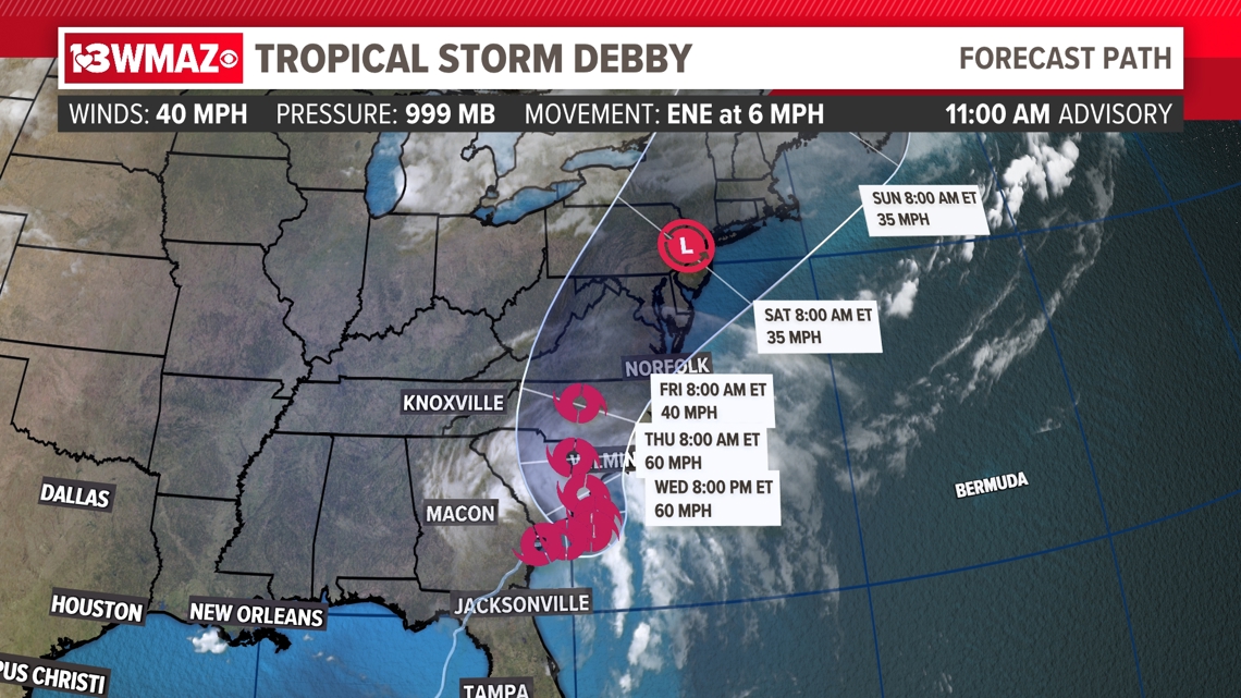
Hurricane Debby cone forecast
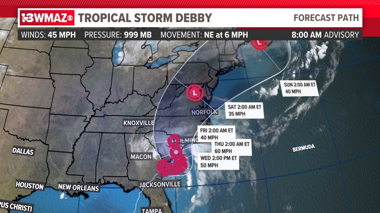
This is what you hear us refer to as the "cone of uncertainty". Everywhere inside the cone shows a possible path that Debby will take and how strong it will be at certain points throughout the next couple of days.
The wider the cone gets, the more uncertainty there is about Debby's potential track, like you see past Wednesday. Therefore, as the cone gets wider, the more important it is to stay up to date on the latest updates as we get them.
Also, impacts are not limited to inside this cone, so areas close to the edge need to pay extra attention to where Debby moves.
Here is the latest cone forecast from the National Hurricane Center for Hurricane Debby as of the 2 a.m. advisory:

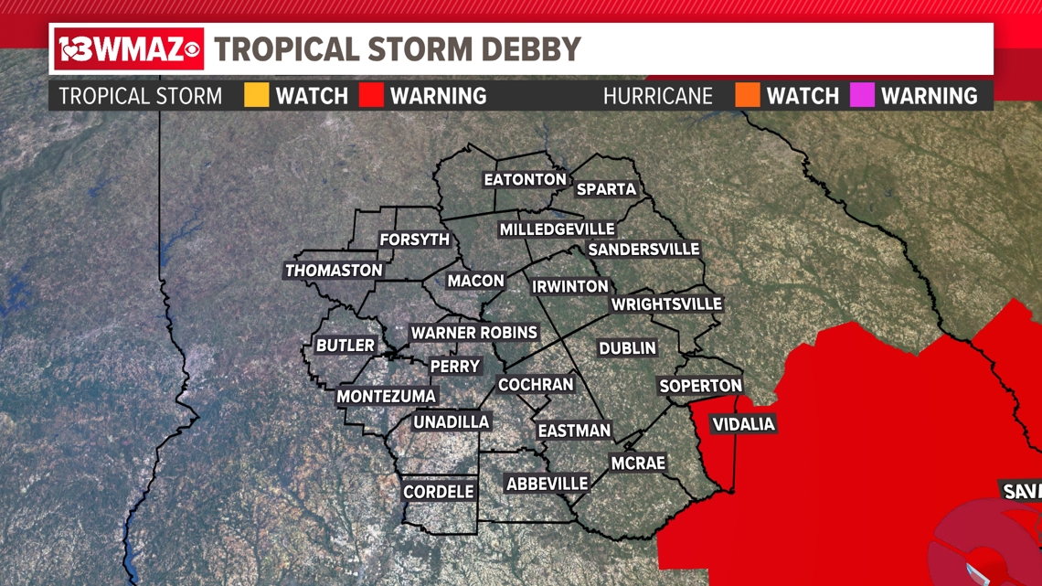
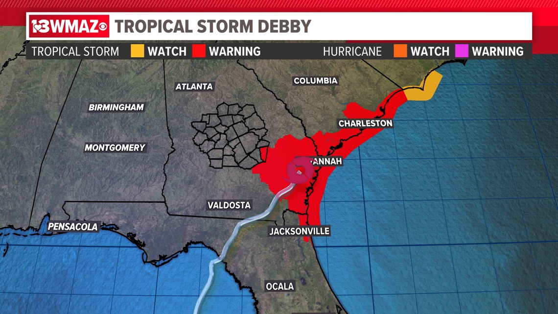
Hurricane Watches and Warnings
A tropical storm watch means tropical storm conditions (sustained winds of 39-74 mph) are possible within the watch area within 48 hours.
A tropical storm warning means that tropical storm conditions are expected within the warning area within 36 hours.
A hurricane watch means that hurricane conditions (sustained winds of 74 mph or greater) are possible within the watch area. A watch is typically issued 48 hours before the anticipated first occurrence of tropical-storm-force winds, conditions that make outside preparations difficult or dangerous.
A hurricane warning means that hurricane conditions are expected within 36 hours. A hurricane warning can remain in effect when dangerously high water or a combination of dangerously high water and exceptionally high waves continue, even though winds may be less than hurricane force.
Here are the latest watches and warnings for counties here in Central Georgia and areas around the Atlantic coast of Georgia, Florida, and South Carolina:


WATCH LIVE:
For more on what is happening right now, you can check out our Hurricane Debby live stream here: