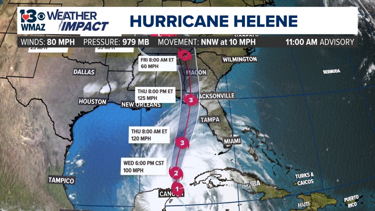
MACON, Ga. — The 13WMAZ weather team has issued a weather impact alert day for all day Thursday, overnight into Friday morning, as Hurricane Helene will approach the southeast. As of Wednesday morning, Helene is forecasted to intensify into a major hurricane of Category 3 status upon landfall and still be a Category 1 hurricane by the time it reaches central Georgia.


Here's what you need to know

When:
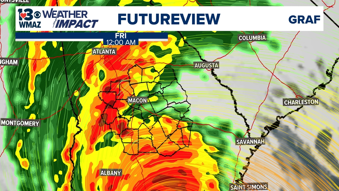
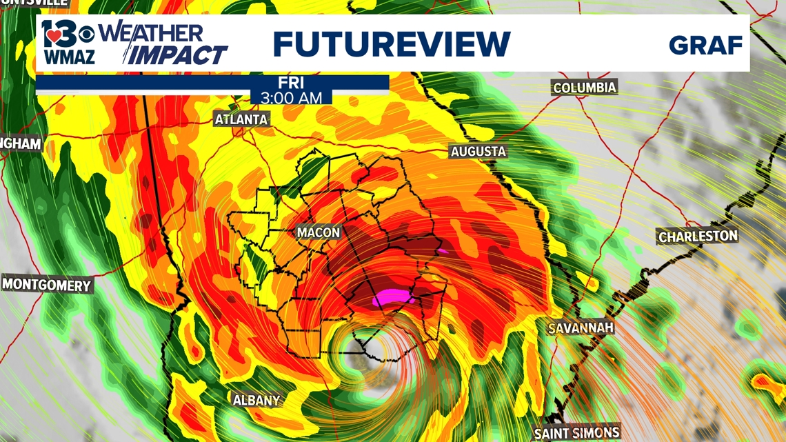
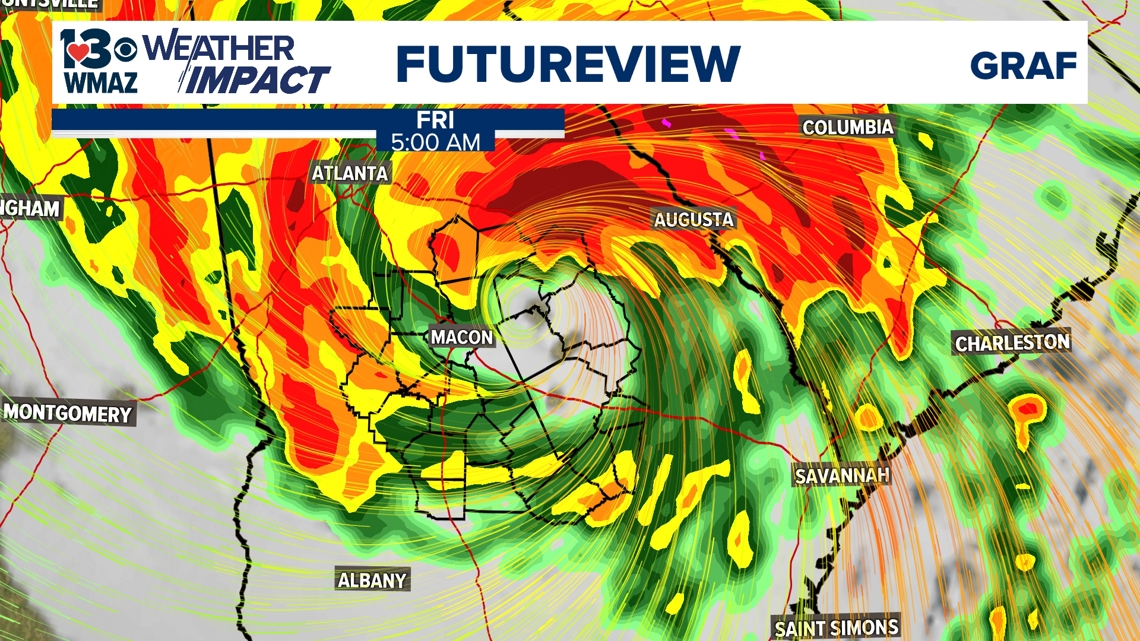
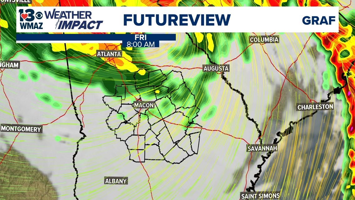
The Weather Impact Alert is for all day Thursday, as outer bands of rain and gusty winds will begin to enter central Georgia during the overnight hours early of Thursday morning. We may get a little break from the rain in the afternoon before it returns Thursday evening in heavier bands and gusty winds arrive as the center of circulation makes landfall and tracks up into our area overnight into Friday. There still is the possibility we extend the Weather Impact Alert for the first half of Friday if we continue to see impacts into the early morning hours on Friday.


Impact:
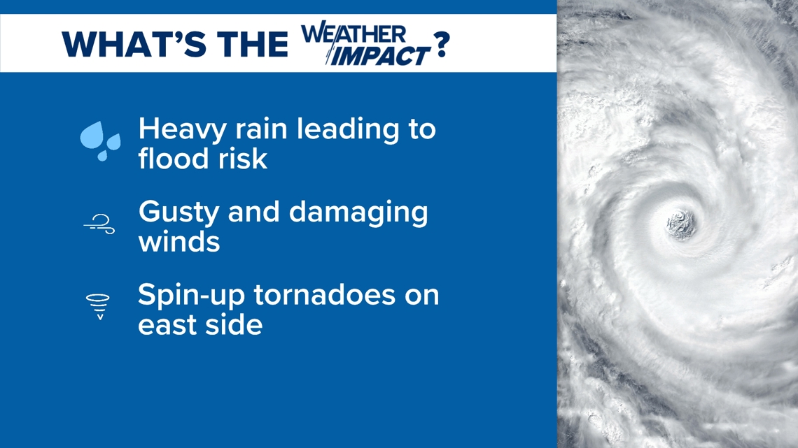
The one thing that is certain is that we will see gusty winds and heavy rain here in central Georgia. The severity of these impacts (wind gust speeds, flood risk, and possible severe weather) is still up in the air all depending on what side of the storm we are on. The east side, or the "dirty side", of the storm would pose a risk severe thunderstorms and the possibility of spin-up tornadoes, as opposed to the west side which is the calmer side. The Storm Prediction Center has gone ahead an issued a Level 1 out of 5 risk for severe weather for much of our southeastern half already on Thursday, along with a Level 2 risk for our far southeastern counties. These risks are subject to change according to what path the storm takes.

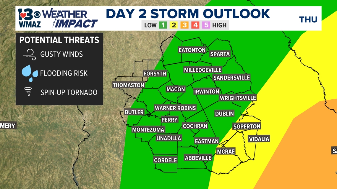
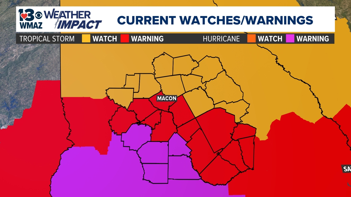
All of our counties are included in some kind of Tropical Watch or Warning. Macon, Dooly, Crisp, Wilcox, and Pulaski counties are under a Hurricane Warning, which means hurricane force conditions (winds of 74 mph or greater) are expected within the next 36 hours. Taylor, Crawford, Bibb, Peach, Houston, Twiggs, Bleckley, Dodge, Laurens, and Telfair counties are under a Tropical Storm Warning, where winds of 39-73 mph are expected within the next 36 hours. A Tropical Storm Watch is in place for the rest of the counties in central Georgia for those tropical storm force conditions being possible over the next 48 hours.

Need:
Be weather-aware throughout the second half of the work week and look for further updates on our 13WMAZ mobile app. The forecast still remains rather fluid, so staying up to date as we get up will be crucial to going about your day.
13WMAZ+
Get more news and information from 13WMAZ by downloading our 13WMAZ+ app on our Roku and Amazon Fire Stick devices.
This allows you to watch more 13WMAZ on-demand and access your favorite 13WMAZ shows like Central Georgia Focus and our Weather Impact Alert explainer.