
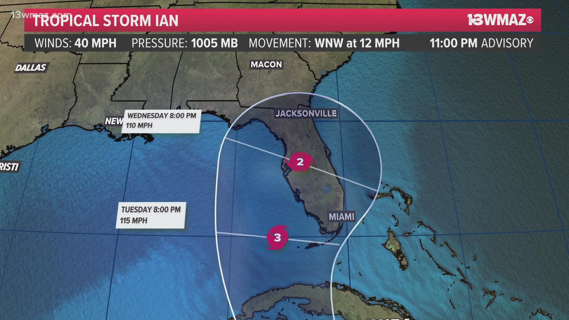
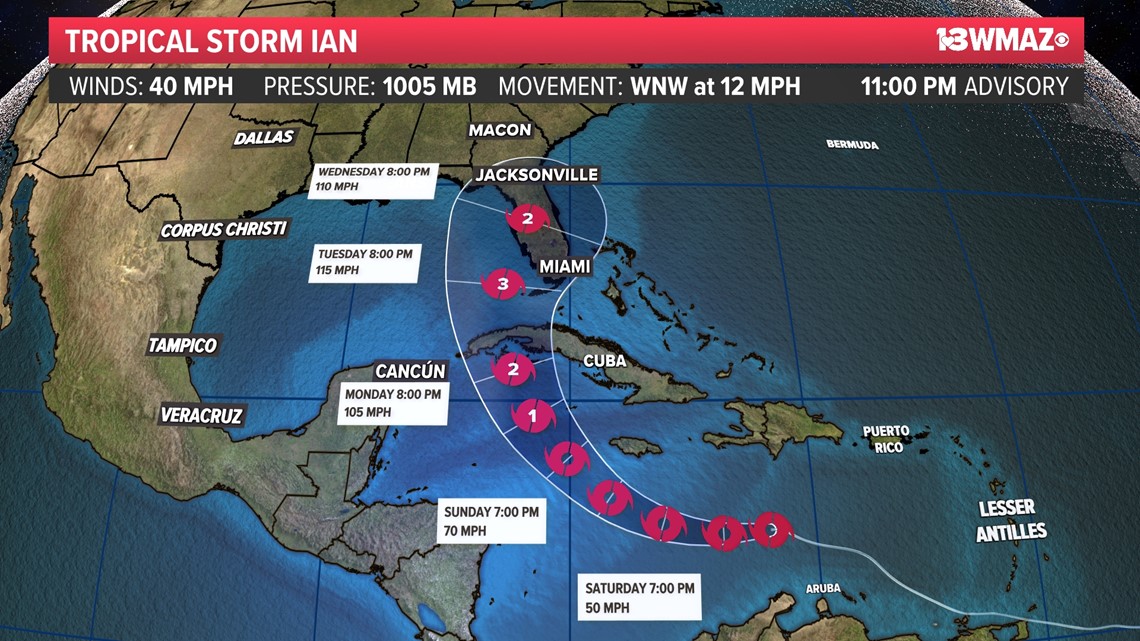
MIAMI — The National Hurricane Center has officially classified Tropical Storm Ian in the southern Caribbean Sea. As of 11 p.m. Friday, the storm had winds of 40 mph and was located about 400 miles southeast of Jamaica.
This system is expected to pass Jamaica to the southwest as it intensifies into hurricane status early Monday morning.
Jamaica and the Cayman Islands are under a Tropical Storm and Hurricane Watch respectively.
The National Hurricane Center's forecast cone shows the storm coming ashore early Wednesday, potentially as a major hurricane, somewhere along Florida's Gulf coast.

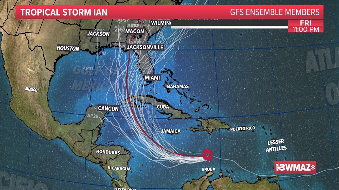
There are several recent model runs that show the storm crossing the Florida peninsula mid-next week. However, this is a recent change and it remains to be seen whether or not this will be trend going forward.
In fact, recent runs of the GFS have favored the western side of the hurricane center's cone, pulling some moisture and energy into central Georgia. Once the storm picks up steam, forecasts will become more fine-tuned; we expect that to happen by Monday.

The conditions for development will continue to improve over the next few days. The storm has been limited by upper-level wind shear for the past several days, which is now letting up.
The 13WMAZ Weather Team is watching the models run to run and will have the latest for you on-air and online. We expect to have a much better handle on the system beginning on Monday.
STAY ALERT | Download our FREE app now to receive breaking news and weather alerts. You can find the app on the Apple Store and Google Play.
STAY UPDATED | Click here to subscribe to our Midday Minute newsletter and receive the latest headlines and information in your inbox every day.
Have a news tip? Email news@13wmaz.com, or visit our Facebook page