
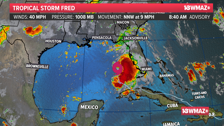
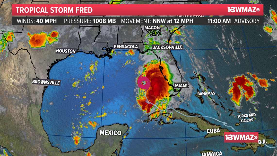
MACON, Ga. — Tropical Storm Fred as of 11 a.m. Sunday has winds of 40 mph as it moves to the NNW at 9 mph with a pressure of 1008 mb. Fred was located about 350 miles south-southeast of Pensacola, Florida.

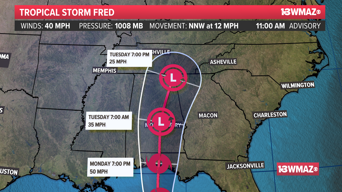
Official National Hurricane Center track:
The latest track from the National Hurricane Center shows Fred approaching the Pensacola area Monday as a mid-grade tropical storm.
As it moves inland the storm will more than likely pass to our west as a tropical depression. The center is forecasted to pass right through Montgomery, Alabama.
This means that Fred will be west of us, leaving Central Georgia on the dirty side of the storm.

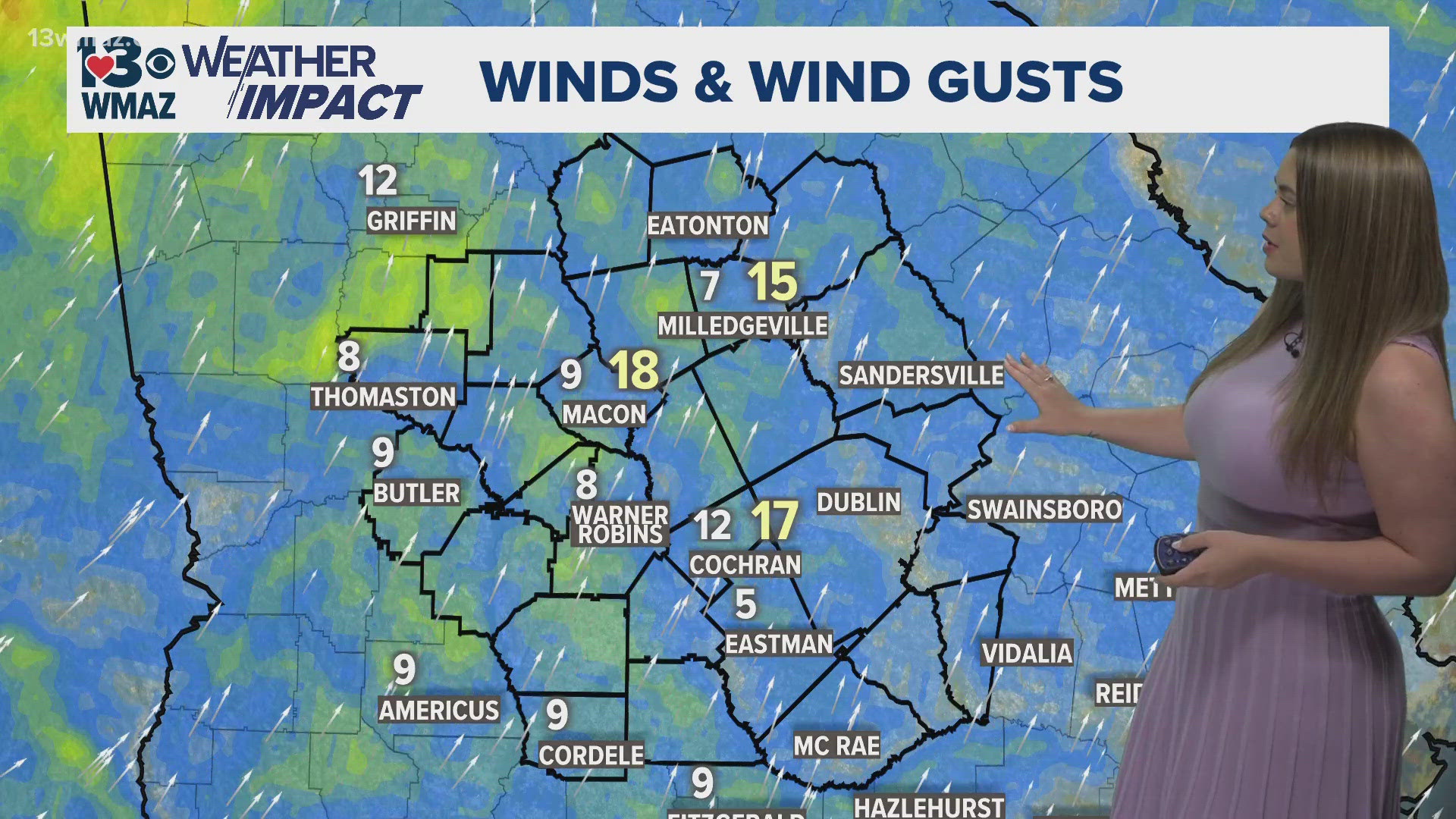
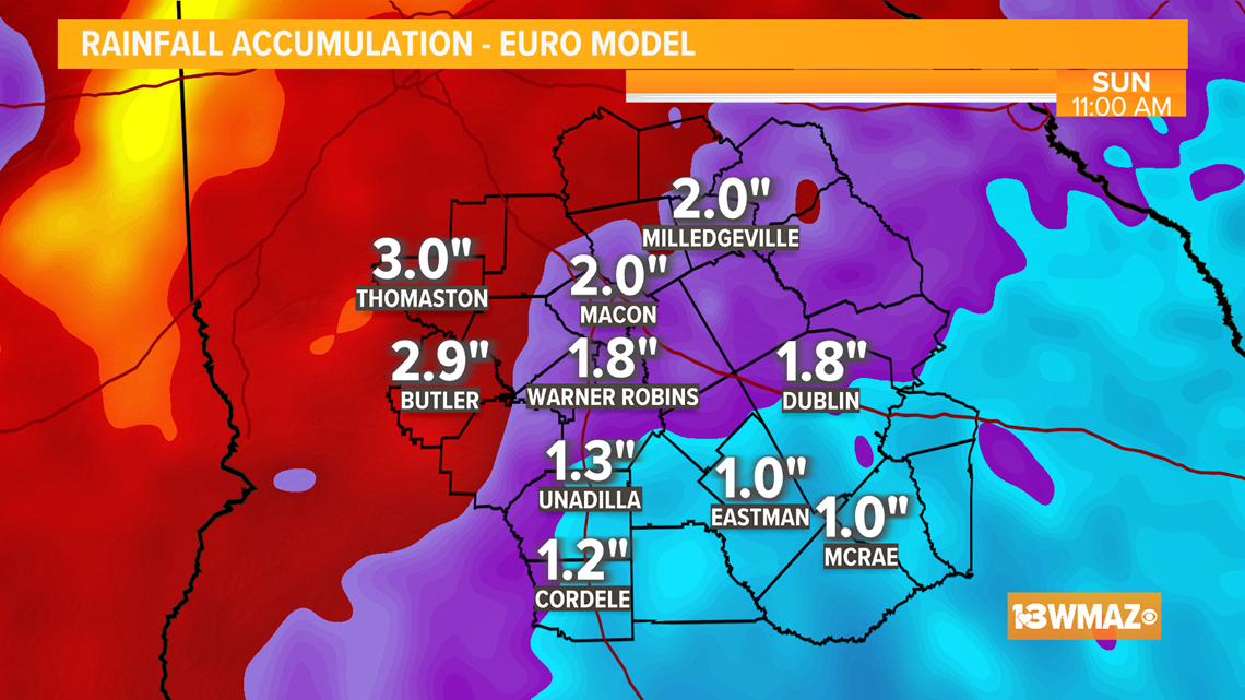
Central Georgia Impacts:
Heavy rainfall will be Central Georgia's primary threat with some strong wind gusts possible. The GFS and Euro vary on how much rain we could see, but both hint that south and west of Macon have the potential for higher rainfall totals.
The Euro hints at a widespread 2-3 inches of rain with locally heavy amounts upwards of 3 inches possible north and west of Macon.

The GFS brings us a widespread 1.5-2 with isolated higher totals upwards of 2 inches or so possible west of Macon. The official NOAA forecast calls for 2-4 inches of rain.
Here is a look at a breakdown of the threats as of right now:


Now that we are in the middle of August, we will starting reaching towards the peak of hurricane season. The official peak is September 10, and we are already seeing the tropics fire up with Tropical Storm Grace right behind Fred.
Hurricane season runs until November 30.
MORE WEATHER