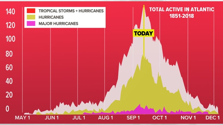
ATLANTA — September 10th marks the climatological 'peak' of the Atlantic Hurricane Season.
About 75% of Atlantic hurricane seasons since the start of the weather satellite era have had a named storm on this date.
The 'Tropical Timeline' chart below shows the tropical frequency throughout the season, which starts June 1 and ends Nov 30. Historically, the months of September and October are active before tropical activity tapers off in the last month of the season.
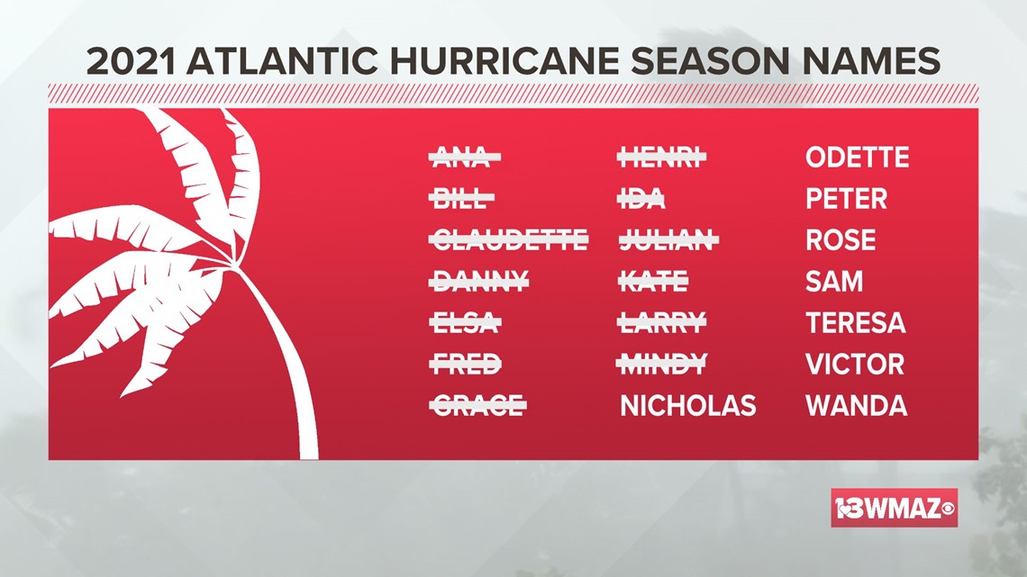
To date, there have been 13 named storms in the 2021 season, 5 of which were hurricanes.
Georgia has been impacted by three of these tropical systems. Claudette brought heavy rain to North Georgia on Father's Day weekend and downed some trees.
In mid-August, Fred produced tornadoes in our area along with heavy rains. At the end of August, Ida passed north of the state, but still brought tropical rain bands.
NOAA does predict a more active than average season with a particularly active second half of the season possible with the forecast of a developing La Nina.
In their updated season outlook released August 4, they call for a total of 15-21 named storms, 7-10 of those reaching hurricane status, and 3-5 major hurricanes.
In the month of September, tropical cyclone formation can be very favorable within the Gulf of Mexico and the Atlantic from the Leeward Islands and southeastern U.S. coastline to the Outer Banks.
As of Friday, there is only one active storm in the Atlantic -- Hurricane Larry. It is transitioning to a post-tropical cyclone and is expected to bring several feet of snow (yes, snow) to Greenland in the coming days.
Elsewhere, we are watching two areas for development, both have a high chance over the next few days. The first is in the Bay of Campeche. The overall upper-level trends are favorable for development and would keep this in the western Gulf of Mexico.
The other storm we are watching is currently rolling off the African coast, far enough away to just keep an eye on at this point.


