
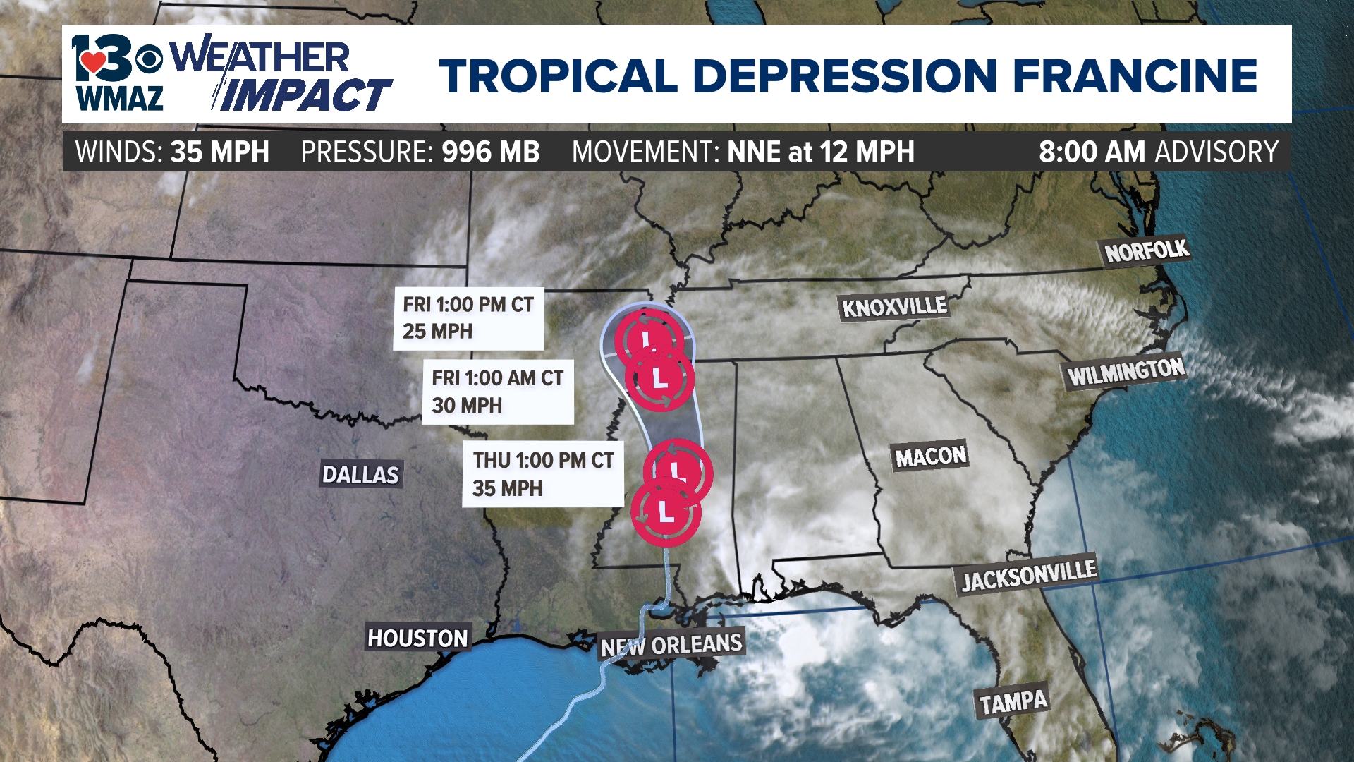
MACON, Ga. — Tropical Storm Francine intensified to a Category 2 Hurricane Wednesday afternoon, shortly before landfall.
Francine had sustained winds of 100 miles per hour as of Wednesday afternoon.
Now, not even 24 hours later, Francine has weakened down into a tropical depression with winds sustained of only 35 miles per hour.


Models indicate the storm will continue to weaken and eventually dissipate by Friday afternoon. However, outer bands are bringing widespread rain and cloud cover to central Georgia many miles away today and tomorrow, with lingering tropical moisture creating good rain chances on Saturday too.
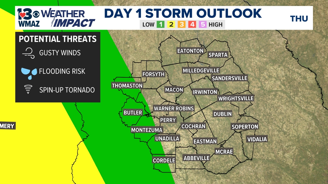
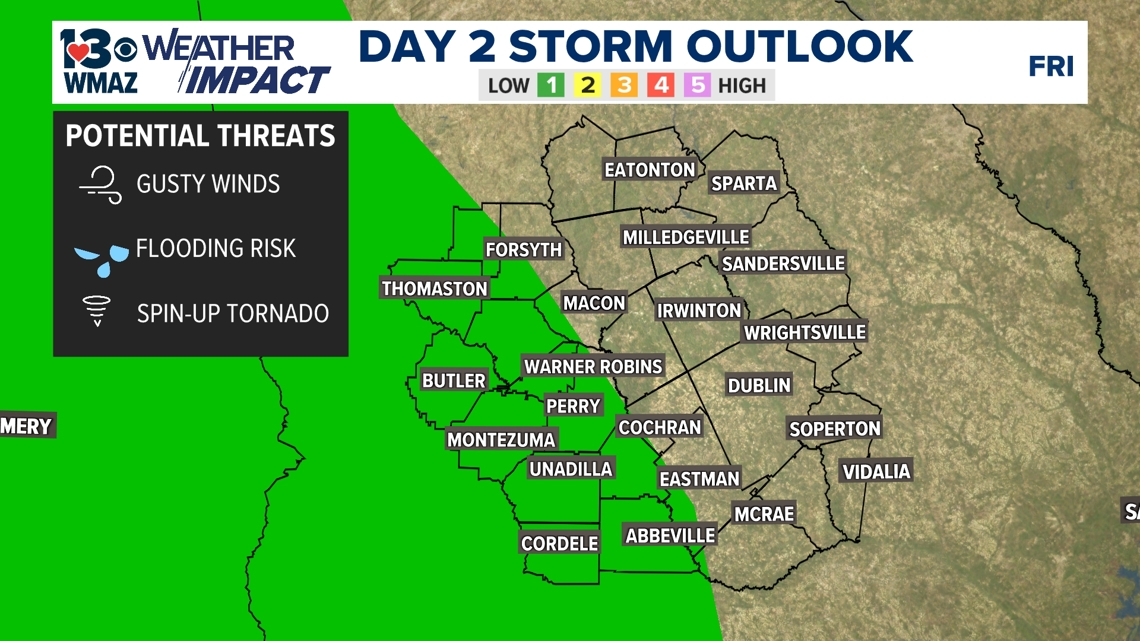
Rain seems to be the main impact we would see at the moment in central Georgia, but of course areas that receive heavy shower after heavy shower will need to be monitored for flash flooding concerns. Gusty winds will be present up to 30-35 miles per hour throughout today, but will weaken into tomorrow. The possibility of a spin-up tornado is highlighted by the National Weather Service, but the main risk looks to be west of us along the Alabama-Georgia Stateline.
The Storm Prediction Center has still outlined much of our west corridor in a Level 1 out of 5 risk for today and tomorrow. A couple more counties farther east are outlined in tomorrow's outlook compared to today's.


We will continue to monitor the development of this disturbance over the next few days and provide updates as we receive them.