MACON, Ga. — Wednesday morning started out with severe weather for many Georgia residents, as the powerful line of storms brought wind, rain, hail and power outages.
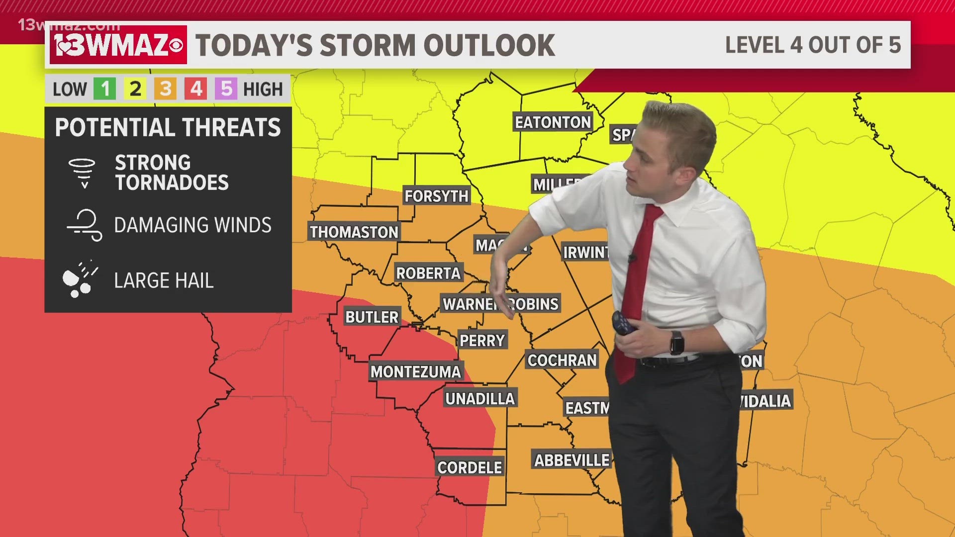
Much of the area is currently under a level 3 or level 4 severe weather threat. The potential for strong tornadoes, winds over 75 mph, and large hail is all in the picture.
There is a level 4 severe weather threat in Taylor, Macon, Dooly, and Crisp Counties. This is part of the larger level 4 that extends back into Alabama and Mississippi.
A level 3 severe weather threat is in place for others including Macon, Warner Robins, Perry, Dublin, Cochran, Eastman, Soperton, Vidalia, Abbeville, Roberta, and Thomaston.
A level 2 severe weather threat is in place for those north and east of Macon, including Forsyth, Milledgeville, Sandersville, Sparta, and Eatonton.
For the full timeline and forecast, check our weather story here.
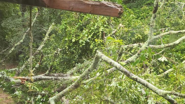
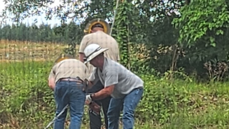
In Telfair County, a tree is down at Highway 280 and Ken White Road.
In addition, there are multiple trees down across the road at Highway 441 and Old Prison Camp Road.
Oconee Fall Line Technical College in Sandersville is closing at noon today due to the weather. The campus is scheduled to reopen tomorrow morning.
Bibb County Schools is dismissing summer programs early on Wednesday because of severe weather threats in the area.
They say:
- Elementary summer programming will dismiss at 12 p.m.
- Middle and High summer programming will dismiss at 1 p.m.
- All athletic programs have been canceled.
- School summer meal service will close at 11:30 a.m. and mobile meal services are canceled
Twiggs County Schools will be closing at 11:30 am today, June 14. Students will be dismissed and all summer afternoon activities are canceled.
Central Georgia storm damage for June 14