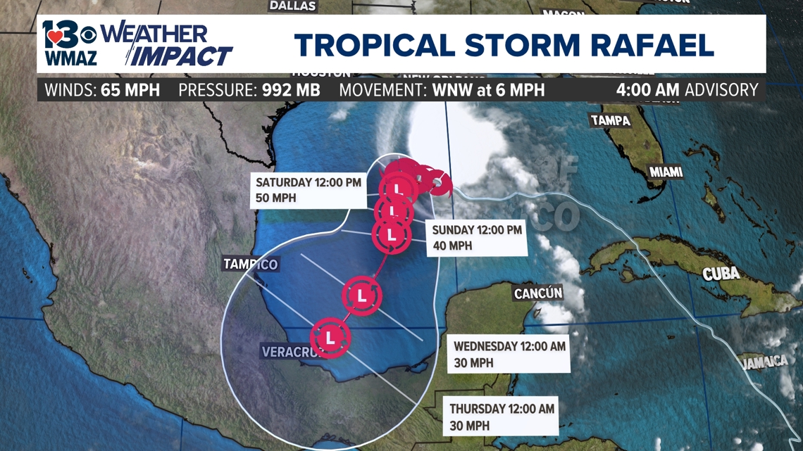
MACON, Ga. — Rafael has officially weakened back down into a tropical storm. At its strongest, Rafael was briefly a Category 3 as it made landfall in Cuba. It will now move into the central Gulf of Mexico, where it is expected to continue to weaken as it interacts with more wind shear.


The new track from the NHC has the storm moving southward toward the Mexican Coast the next day, aided by the clockwise flow from a high-pressure system in Mexico. However, it will encounter a stall during the weekend, where the storm will continue to weaken from the strong wind shear present. The wind shear or (changes of wind in regards to height) will disorganize the formation of the storm.
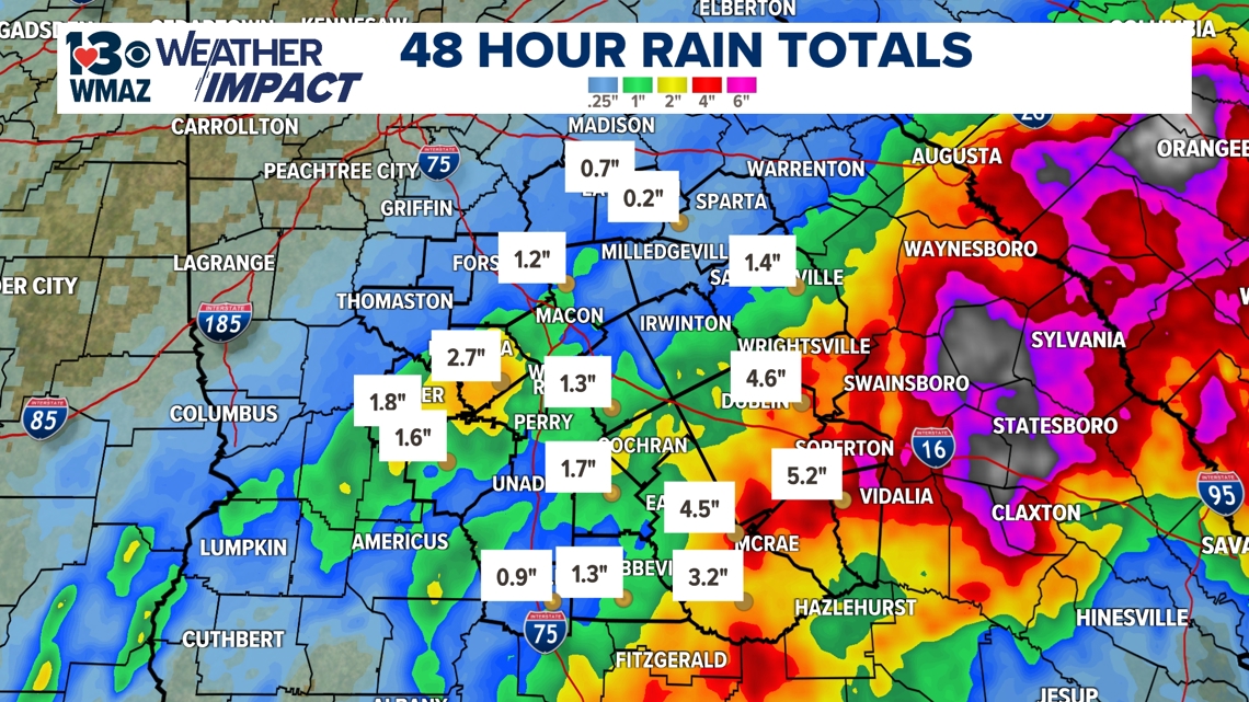
While the track doesn't look to come near central Georgia, we received some high rainfall totals in the past couple of days. Most totals ranged from 1 to 3 inches across the area. Our southeastern counties received the bulk of the rain, with some locally heavy spots taking in 4 to 6 inches in the past two days.


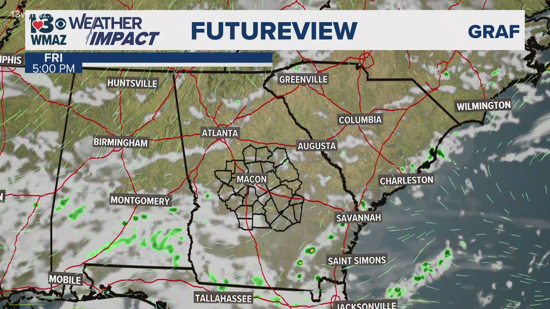
Most of the rain has left our area. The weekend still hangs on to that tropical moisture just a tad, creating a chance of scattered light showers on Saturday and Sunday. Having the umbrella handy will be a wise choice if you have to duck and dodge a sprinkle or two for any outdoor plans this weekend. However, as we head into the end of the weekend, another wedge tries to build in to push some drier air in to possibly inhibit those rain chances.

