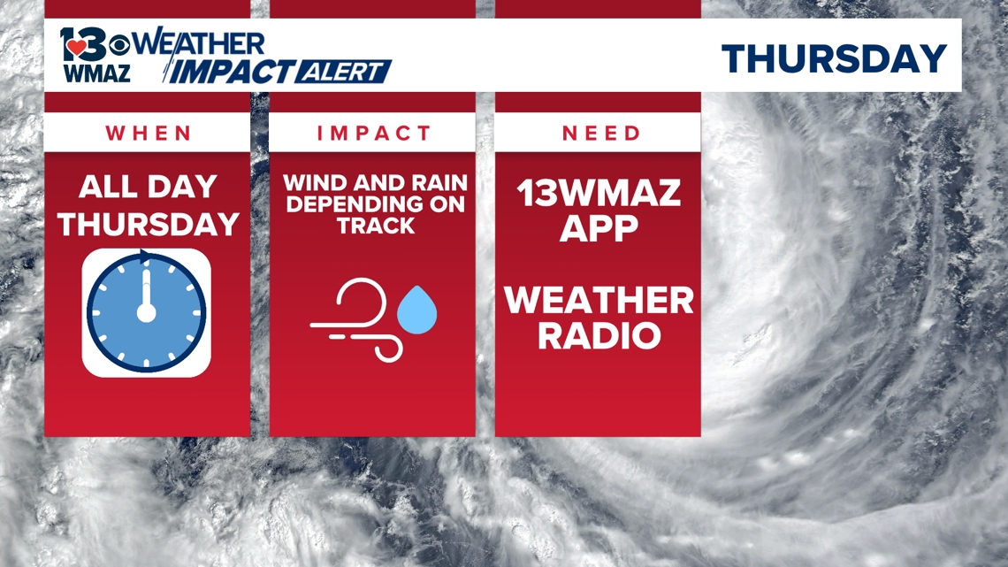
MACON, Ga. — We have issued a Weather Impact Alert for Thursday for all of central Georgia.
While there is still some uncertainty of the exact track of this tropical system, as of now, gusty wind and heavy rain is looking likely for our area. Over the next day or two, we could see a shift in the track, so the forecast is not set in stone.

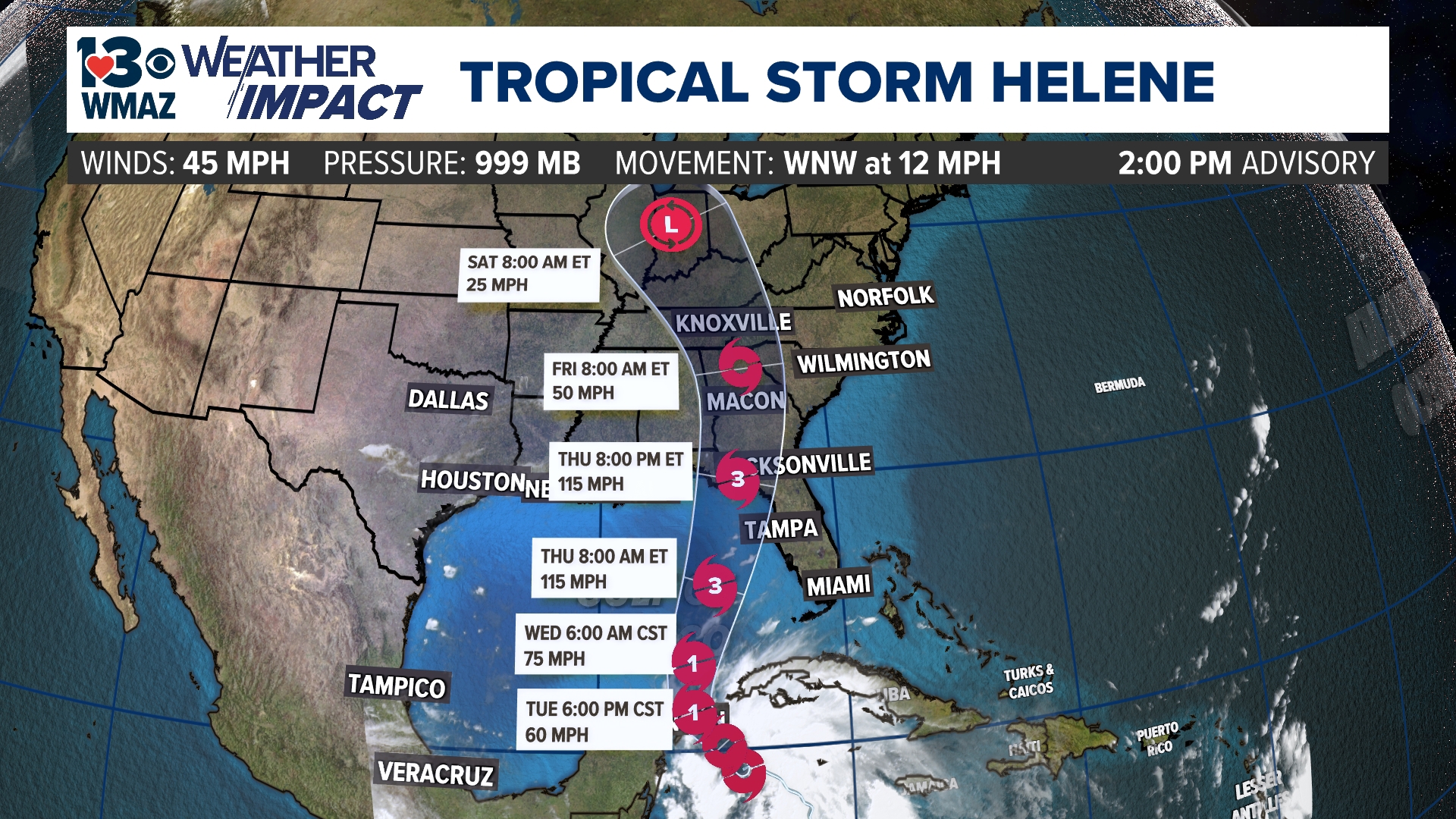
As of the 11 a.m. update from the National Hurricane Center, Potential Tropical Cyclone Nine has reached Tropical Storm status, making it our 8th named storm of the season, Helene.
The forecast cone for Helene continues to remain relatively the same, and it follows what long-range models have been saying with a landfall anywhere from Panama City Beach all the way down to Tampa along the Florida Gulf coast.
The center of this cone goes right over us here in central Georgia, but where the center of circulation passes through is still a little up in the air. This forecast also has this system intensifying into a Category 3 storm before landfall.


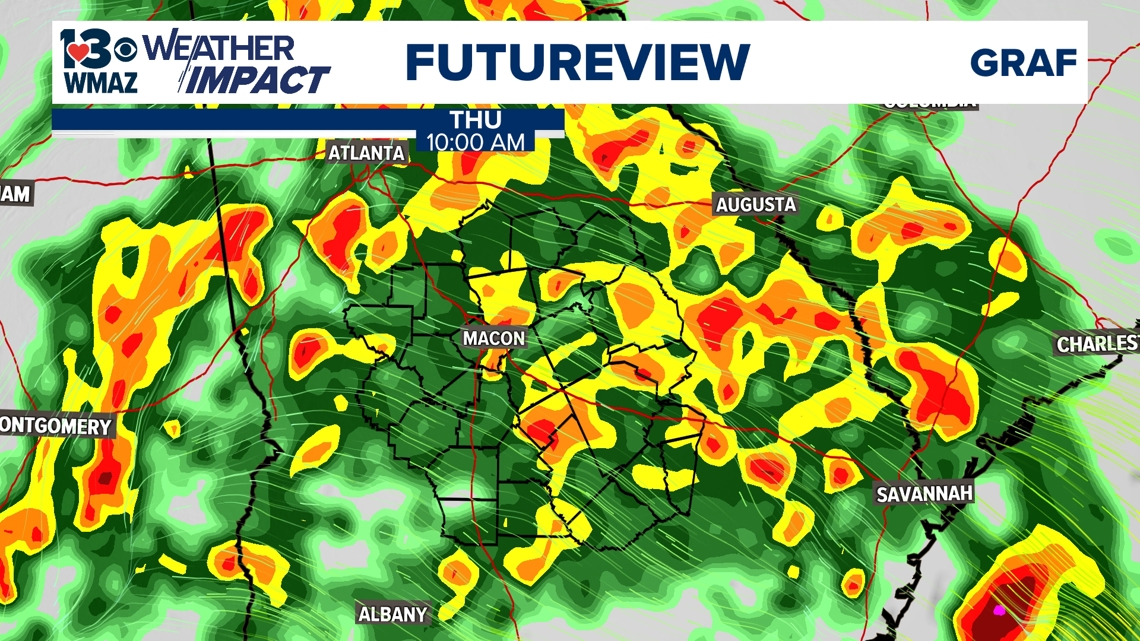
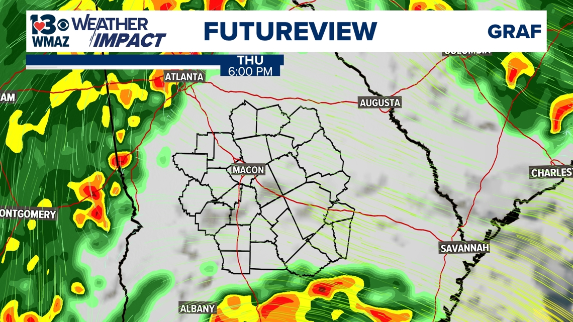
Model guidance and the National Hurricane Center's forecast products include central Georgia in the path of this system. Models indicate that central Georgia could begin to see rain bands from the system as early as late Wednesday night through early Friday morning.

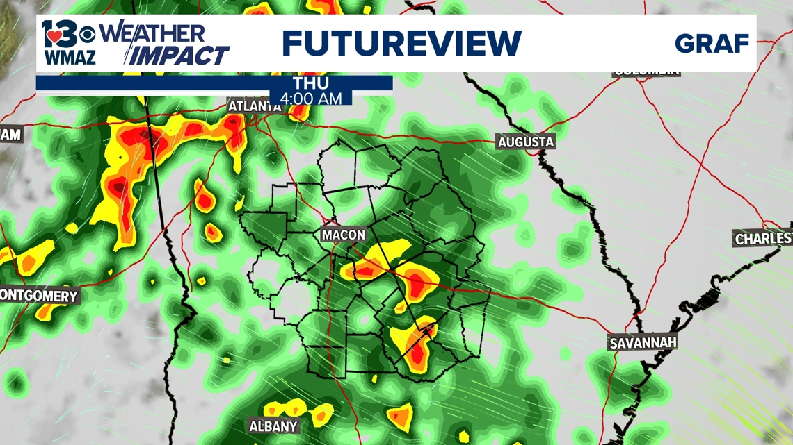


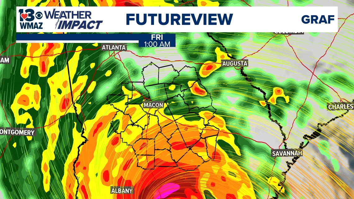
The main thing we are watching, is to see what side of the very center of this storm we are on. If we are on the west-side of the storm, we won't have the severe weather impacts that we will if we are on the east, or "dirty side", of this system.
Right now we are expecting to see heavy rainfall and some gusty winds, but severity of these impacts is still to be determined.
Once again, it remains something we are keeping a very close eye on here with the Weather Team, and we will continue to provide updates as we get them.