MACON, Ga. — The National Oceanic and Atmospheric Administration (NOAA) recently released its predictions for the 2022 Atlantic Hurricane Season, and they are planning for an active few months.
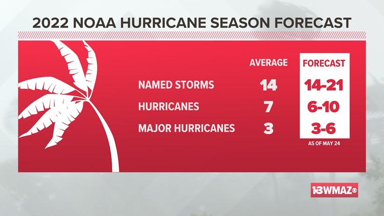
NOAA expects roughly 20 named storms, with up to 10 potentially becoming actual hurricanes.
For storms to receive a name, the winds within the system have to exceed 39 mph.
This year's numbers are well above the average for a hurricane season, but they follow the trend of recent years. If these projections play out accurately, it would mark the seventh-straight year a more active hurricane season would occur in terms of frequency of storms.
The reason why the tropics have been so active the past few years is credited to a phenomenon referred to as La Niña, the "cold phase" of a global wind alteration.
La Niña occurs when trade winds off the coast of South America strengthen and move warm surface water further away into the Pacific Ocean, resulting in the upwelling of cooler water further below the surface.
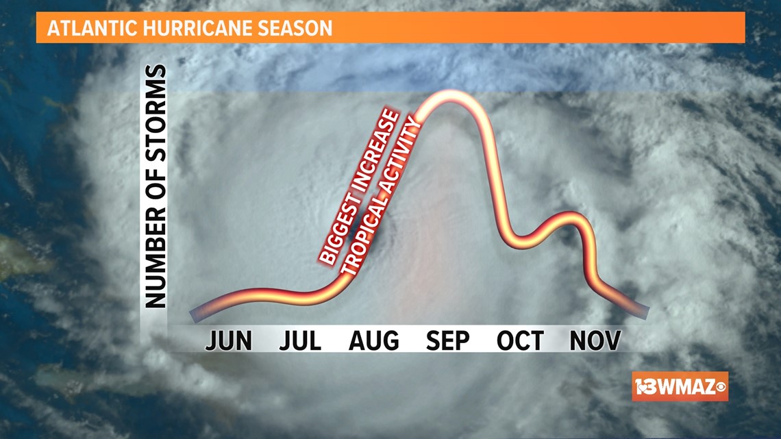
Consequently, in an attempt to balance this shift in wind and water temperature, the Atlantic Ocean warms and winds slow down, creating a perfect breeding ground for hurricanes.
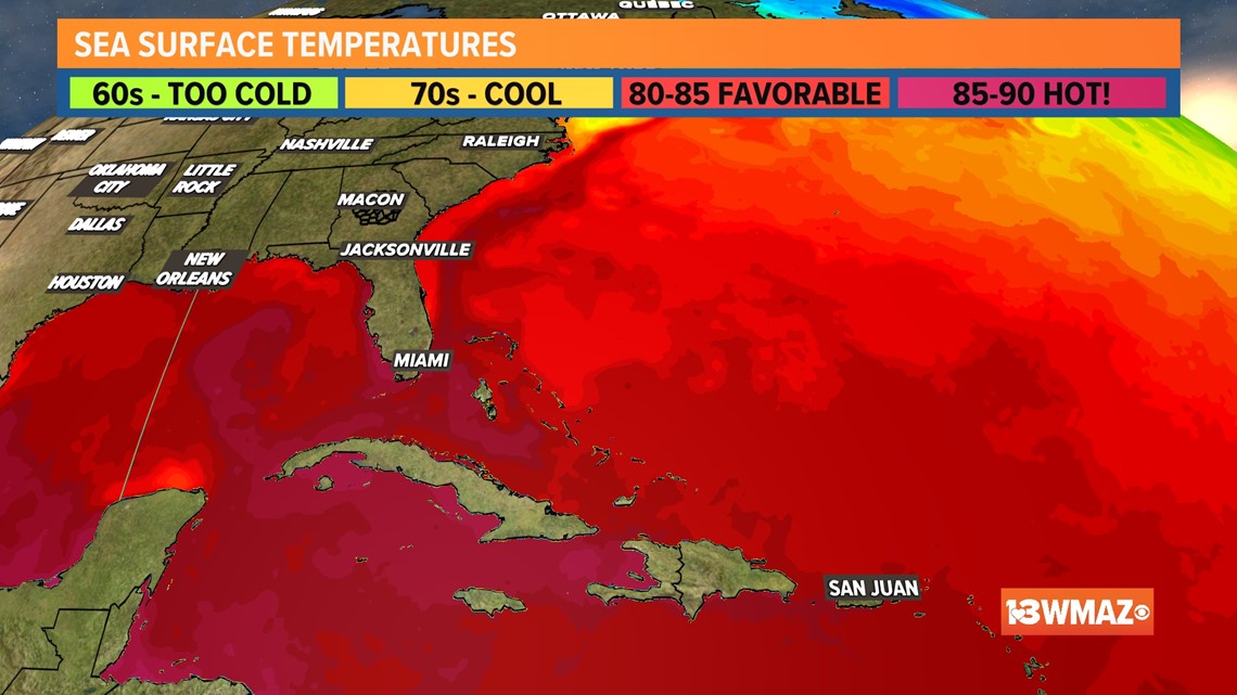
These warmer waters in the Atlantic also include the Gulf of Mexico and the Caribbean Sea. Surface water temperatures are already soaring to almost 90 degrees in some areas this spring, well before the official start to the summer.


It's important to note that these forecasts don't indicate where storms will make landfall -- just how many storms are forecasted to form.
Nonetheless, stay weather aware during this hurricane season as we keep our eye on the tropics.


