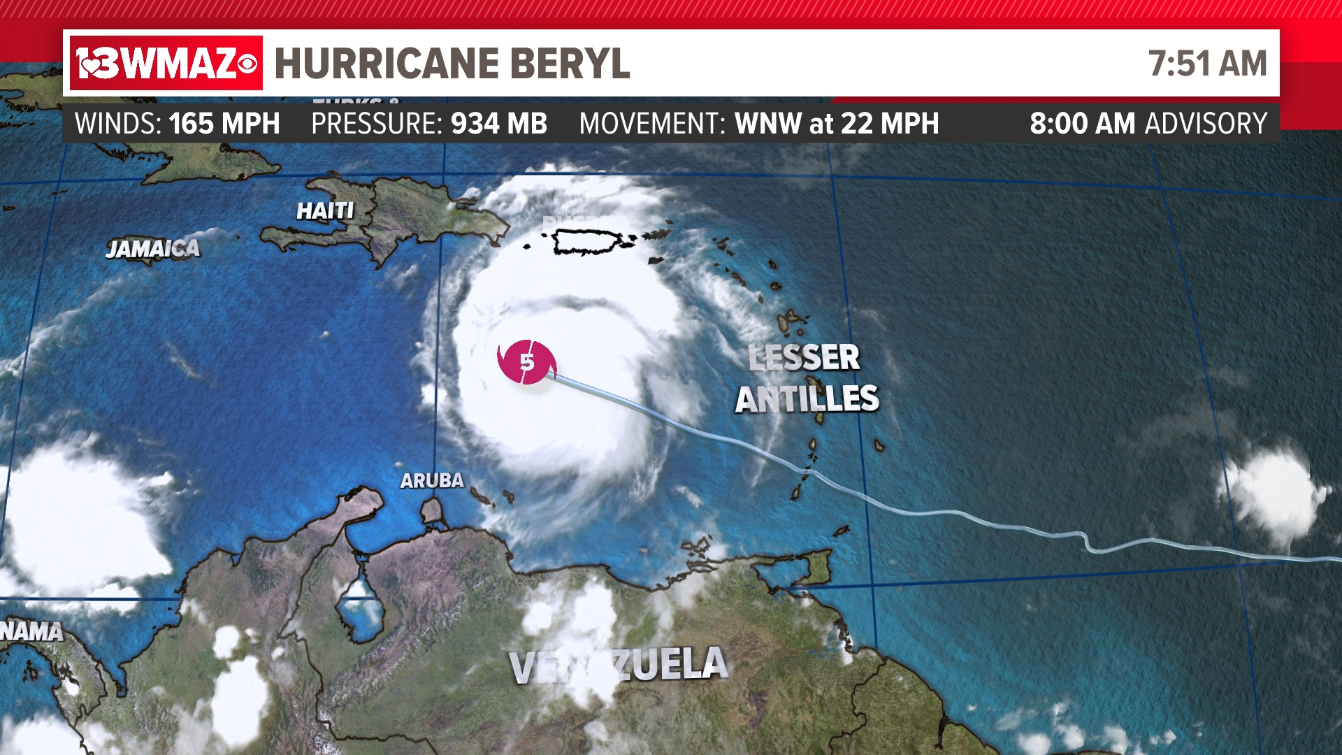
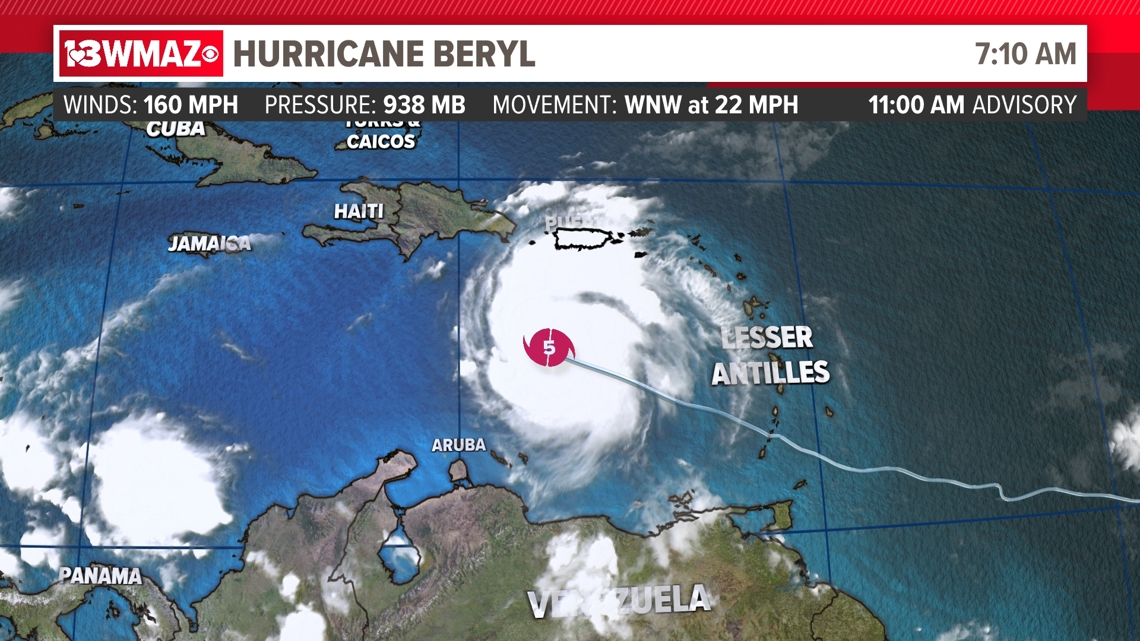
MACON, Ga. — Hurricane Beryl continues to remain a monster hurricane of Category 5 status located in the east Caribbean Sea between Puerto Rico and Venezuela. As of the 11 a.m. advisory from the National Hurricane Center, Beryl has winds of 160 mph, a central -low-pressure of 938 MB, and is moving west-northwest at 22 mph.

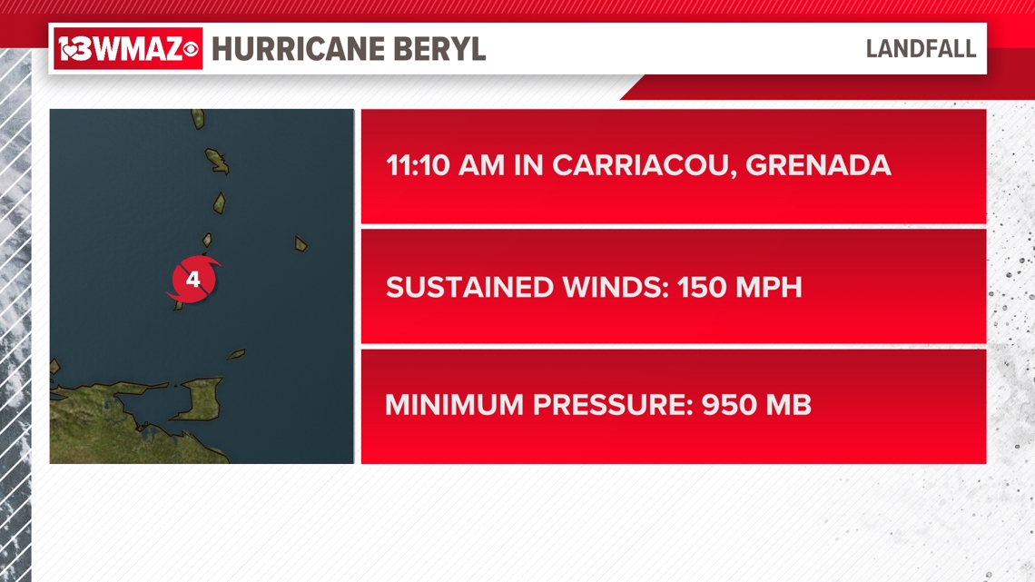
When Beryl made landfall yesterday on the island of Carriacou in the Caribbean nation of Grenada, it was a Category 4 storm with winds of 140 mph and a pressure of 950 MB.
So the storm continues to intensify in the warm waters of the Caribbean.

The storm will create heavy rain and a life-threatening storm surge, along with very damaging winds. It will continue to move in a west-northwest direction through the southern Caribbean Sea, where some weakening is expected due to wind shear, or increasing winds with height that disrupt circulation.
Beryl is still forecasted to maintain at least Category 2 status as it treks towards northern Central America and the Yucatan peninsula later this weekend. After that, there is some uncertainty about where Beryl will head. It could stay its course into central Mexico, or take a more northern turn into the Gulf Coast of Texas or Louisiana and Mississippi.
As we move closer to the weekend we will get a better idea of its track.
With it being 4th of July weekend and possible cruises being taken, areas like Jamaica, Belize, and Cancun will be impacted later in the week. Be prepared to have a contingency plan or warned that weekend plans in those areas of the Caribbean will be redirected more than likely.

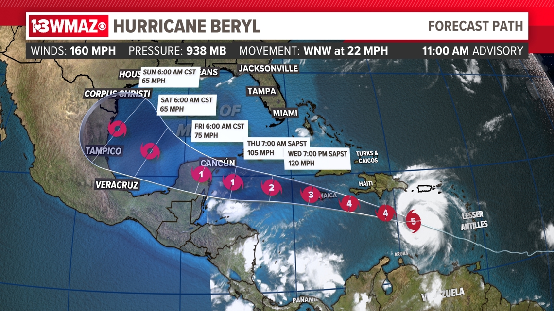
No impacts are forecasted for Central Georgia, but it is not impossible that we see this storm change direction once it enters the Gulf of Mexico.
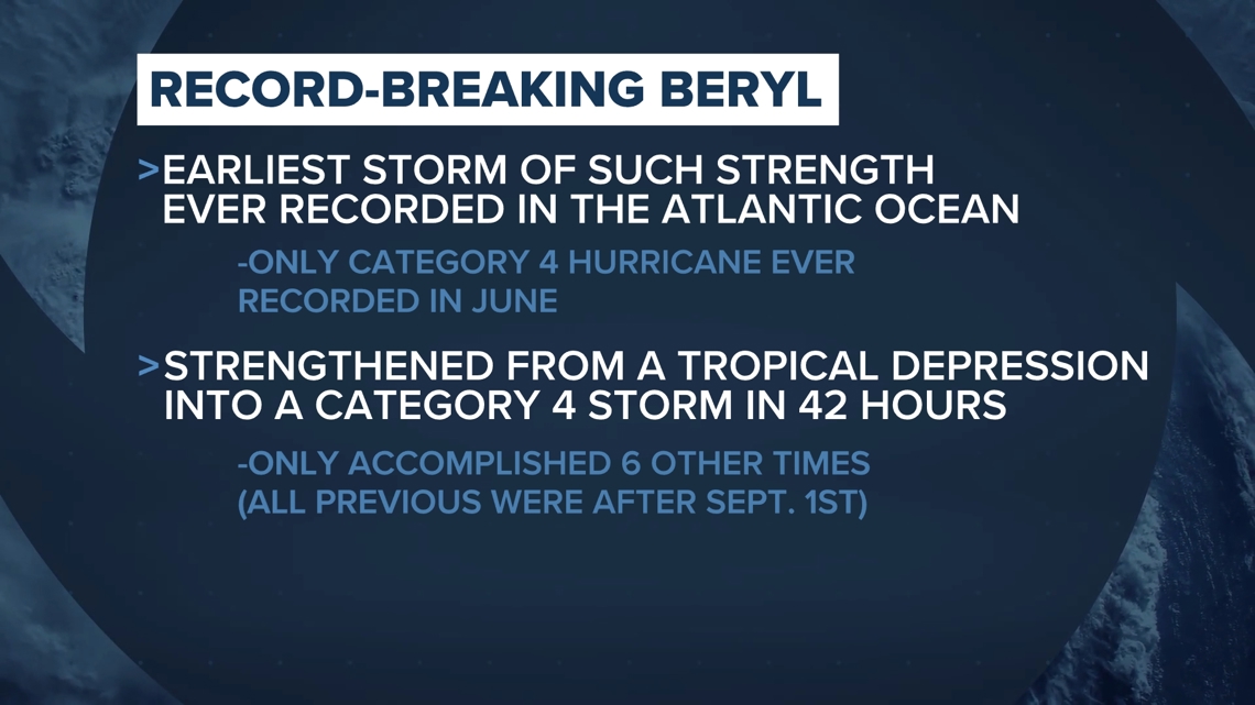
Hurricane Beryl made history Sunday morning, becoming the first Category 4 hurricane ever recorded in June. The average date we typically see the first hurricane form is August 11, meaning that this storm came way earlier than expected.
The rapid intensification process Beryl underwent from a tropical depression to a Category 4 storm took only 42 hours, something we've only seen a handful of other times. All previous storms that intensified so quickly came after September 1.

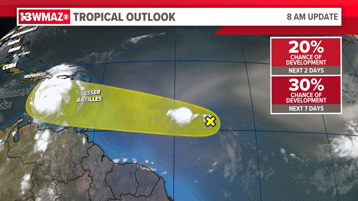
Another area of interest follows right behind Beryl in the east Atlantic Ocean. This low-pressure system has only a 20% chance of development over the next 48 hours, but a 30% chance of development over the next week.
We'll continue to track its progress over the next few days along with Beryl.