MACON, Ga. — A couple of weather disturbances and an increase in moisture finally ended our long, dry stretch of weather across Central Georgia.
Prior to Sunday, Macon had not seen measurable rainfall since September 10th, and that was only .01" of rain. We were stuck in an incredibly hot and dry pattern that allowed drought conditions to expand and intensity. Now, maybe things are on the right track.
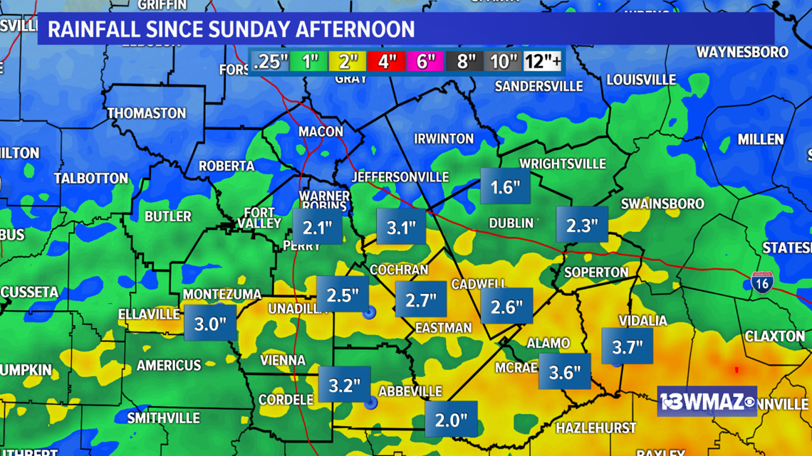
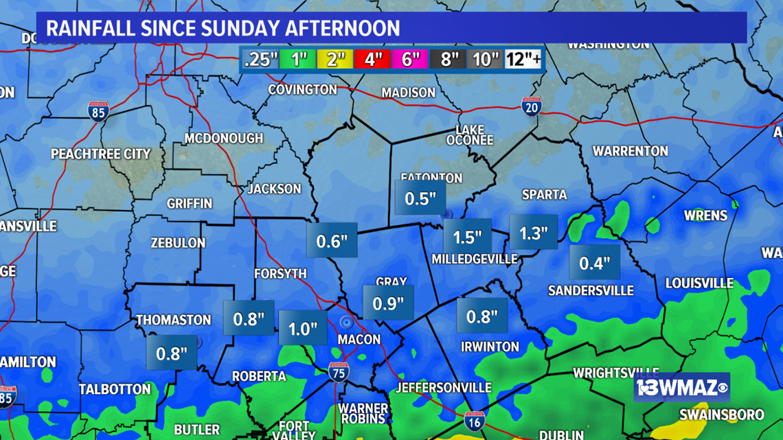
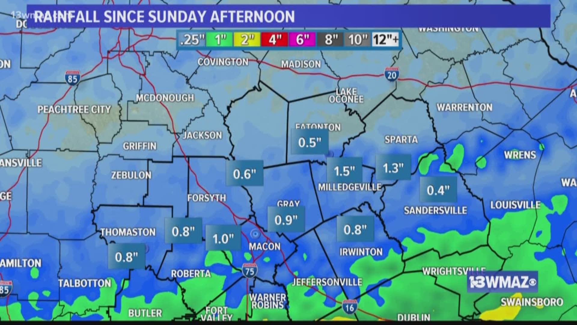
Doppler estimated rainfall shows most of Central Georgia picked up 1 to 3 inches of rain. The heaviest rain fall south of I-16. Parts of Laurens, Dodge, Telfair, and Wheeler counties received over 3 inches of rainfall.


I'm optimistic that this won't be an isolated event. This weekend looks to be on the wet side as well as a tropical wave approaches from the southwest. Confidence is increasing that this system will bring us another round of widespread rainfall. Beyond this weekend, fronts in the extended models don't appear near as dry as the ones we have seen pass by recently.
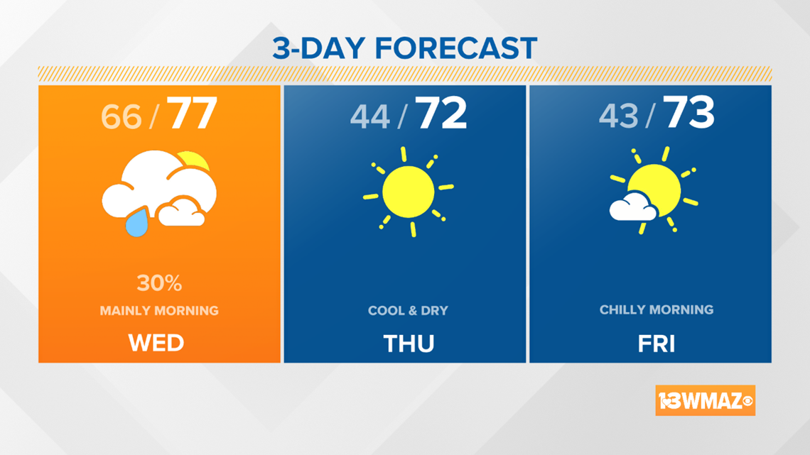
Here's how the forecast looks right now:
We're not out of the drought yet, but let's hope these trends continue.
STAY ALERT | Download our FREE app now to receive breaking news and weather alerts. You can find the app on the Apple Store and Google Play.
STAY UPDATED | Click here to subscribe to our Midday Minute newsletter and receive the latest headlines and information in your inbox every day.
Have a news tip? Email news@13wmaz.com, or visit our Facebook page.


