Central Georgia's Guide to the 2023 Hurricane Season with names and forecast
Forecasters are expecting a near-normal season ahead with several named storms and a couple major hurricanes.

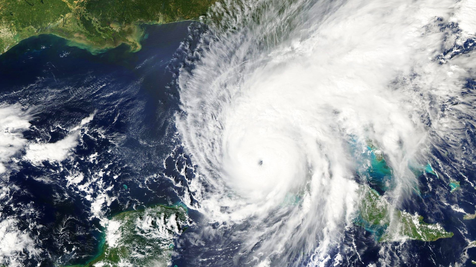
The 2023 hurricane season has arrived and forecasters are expecting a near-normal season ahead. That means we can expect to see tropical storms, hurricanes, and major hurricanes in the Atlantic basin.
Even though Central Georgia is not on the coast, we can see our fair share of impacts from tropical systems. In fact, the biggest flood in Central Georgia history came from a tropical storm in 1994. Not to mention, the devastating agriculture economic impact from Hurricane Michael in 2018.
Here's what you should know for the 2023 hurricane season.
Names
Names from tropical systems are determined by the World Meteorological Organization and are recycled every six years. If a storm is devastating enough, a country can request that a name be retired and never be used again. The United States did this in 2022 with Hurricane Ian.
Here are the names for the 2023 season.
- Arlene
- Bret
- Cindy
- Don
- Emily
- Franklin
- Gert
- Harold
- Idalia
- Jose
- Katia
- Lee
- Margot
- Nigel
- Ophelia
- Philippe
- Rina
- Sean
- Tammy
- Vince
- Whitney
This list was most recently used in 2017. The names Harold, Idalia, Margot, and Nigel replace Harvey, Irma, Maria, and Nate.
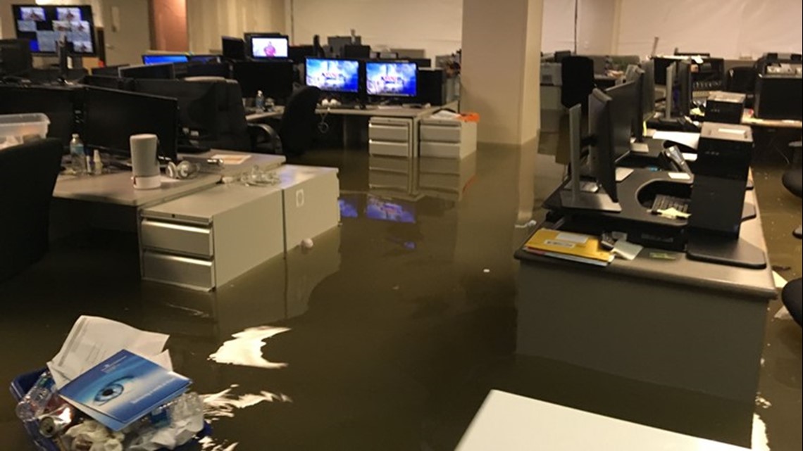
Hurricane Harvey brought devastating wind impacts to the Texas coast and widespread flooding to the Houston metro area. 13WMAZ's sister station, KHOU, was even flooded out of their studios and had their signal knocked off the air. The United States requested the name Harvey be retired.


Hurricane Irma made landfall in southwest Florida, came up the peninsula, entering central Georgia and causing widespread damage while doing so. The United States requested the name Irma be retired.
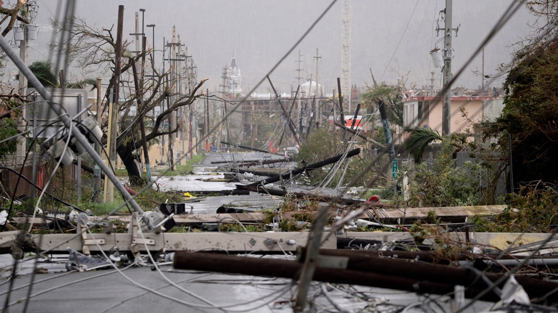
Hurricane Maria struck Puerto Rico as a high-end category 4, knocking our power to most of the island and even the radar used to monitor the storm. Many in the US territory are still feeling the impacts from Maria today. The United States requested the name Maria be retired.


Forecast
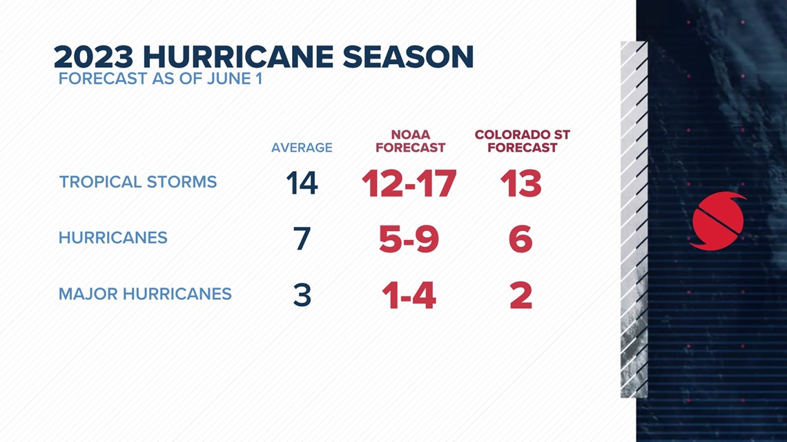
NOAA forecasters are expecting a near-average season with 12-17 named storms, 5-9 hurricanes, and 1-4 major hurricanes. The government agency has 70% confidence in this forecast.
Dr. Philip Klotzbach, a forecaster specializing in Atlantic basin seasonal hurricane forecasts at Colorado State University, agrees with 13 named storms, 6 hurricanes, and 2 major hurricanes.


In 2022, we saw 14 named storms, 8 hurricanes, and 2 major hurricanes. It's worth noting that the season started on a quite note with only three named storms between June and August. Most of the activity came in the fall, after September 1.
A big change from last year - La Niña is no more. Waters in the equatorial Pacific Ocean have warmed, causing wind shear to be not as conducive in the Atlantic for development. Just because La Niña is over does not mean El Niño immediately takes over. We will be in a neutral phase for the short term, entering hurricane season.
The Cone
The iconic forecast cone shows the potential track for the center of a tropical cyclone. The National Hurricane Center uses forecast errors from past years to determine the cone's width at different forecast times. The storm is expected to stay in the cone two-thirds of the time and track outside of the cone one-third of the time.
Bottom line, the cone does not show where impacts are expected, only the where the center is forecasted to go. Even then, the expectation is that the center stays within the cone only two-thirds of the time.
Terms to Know
Hurricane: A tropical cyclone in which the maximum sustained surface wind is 74 mph or more.
Major Hurricane: A hurricane that is classified as Category 3 or higher.
Tropical Storm: A tropical cyclone in which the maximum sustained surface wind speed ranges from 39 mph to 73 mph.
Tropical Depression: A tropical cyclone in which the maximum sustained surface wind speed is 38 mph or less.
Potential Tropical Cyclone: A term used in NWS advisory products to describe a disturbance that is not yet a tropical cyclone, but which poses the threat of bringing tropical storm or hurricane conditions to land areas within 48 hours.
Rapid Intensification: An increase in the maximum sustained winds of a tropical cyclone of at least 35mph in a 24-hour period.
Landfall: The intersection of the surface center of a tropical cyclone with a coastline. Because the strongest winds in a tropical cyclone are not located precisely at the center, it is possible for a cyclone's strongest winds to be experienced over land even if landfall does not occur. Similarly, it is possible for a tropical cyclone to make landfall and have its strongest winds remain over the water.
Saffir-Simpson Hurricane Wind Scale: The Saffir-Simpson Hurricane Wind Scale is a 1 to 5 categorization based on the hurricane's intensity at the indicated time. The scale provides examples of the type of damage and impacts in the United States associated with winds of the indicated intensity.
- Category 1: 74-95 mph
- Category 2: 96-110 mph
- Category 3: 111-129 mph
- Category 4: 130-156 mph
- Category 5: 156 mph+
The strongest part of any tropical system will always be around the eye or center. For example, if you have a category 4 hurricane coming ashore, the category 4-force winds will only be felt in a small area around the eye. The winds get gradually weaker the further out you get.

