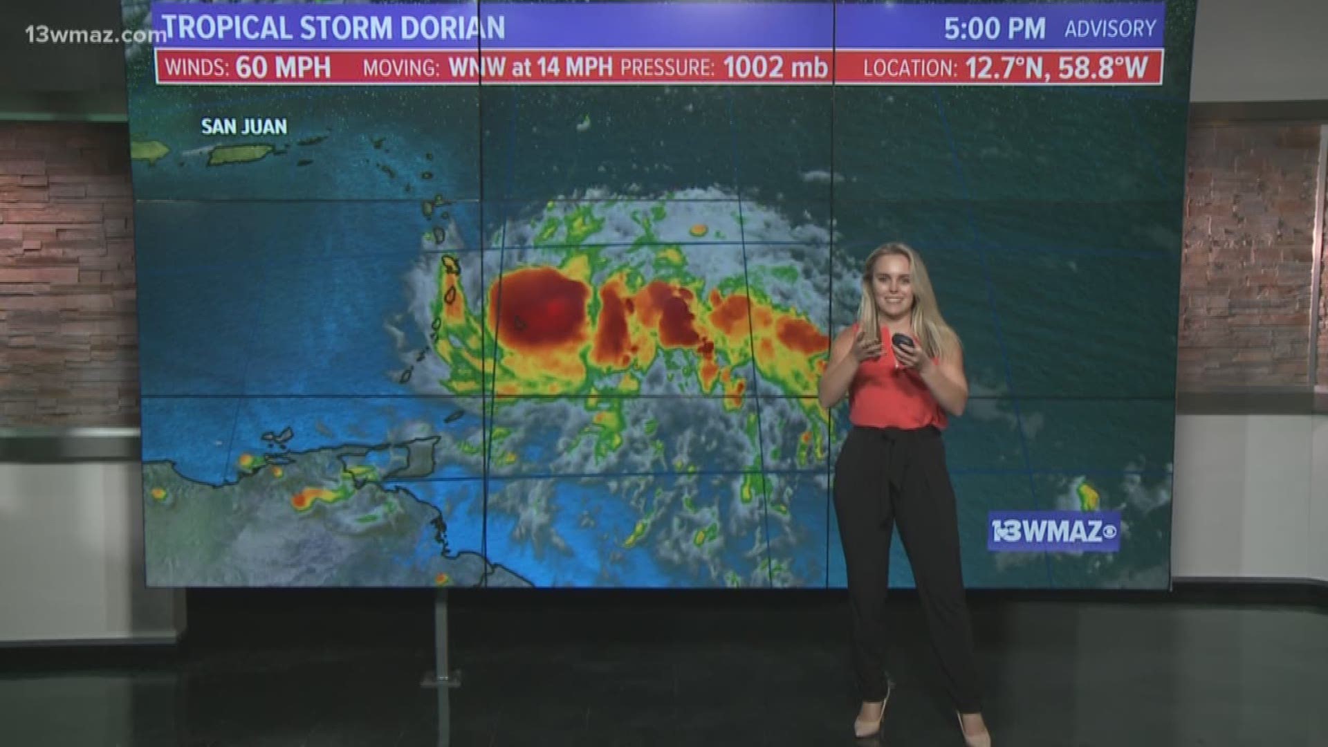
As of the 5 p.m. advisory on Monday, August 26th, Dorian remains a tropical storm.
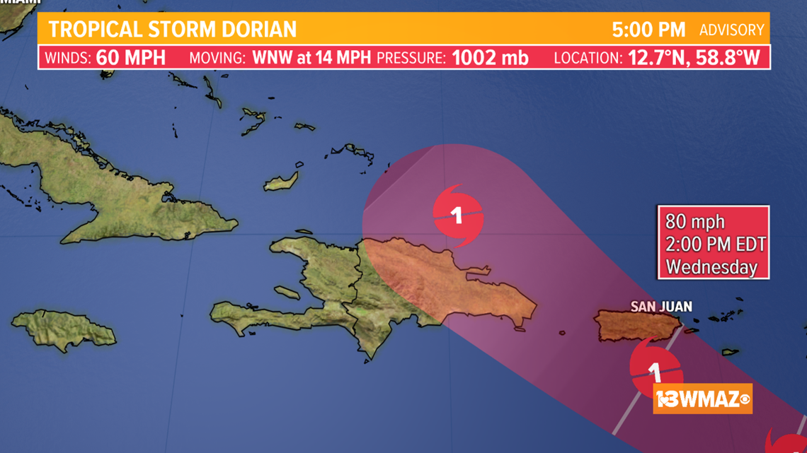
In the coming days, the storm is forecast to strengthen into a Category 1 hurricane as it approaches the Dominican Republic and Haiti, which together create the island of Hispaniola.


The way hurricanes work is they use the warm, moist air over the water and pull that into its center. It then condenses, releasing large amounts of stored up latent heat.
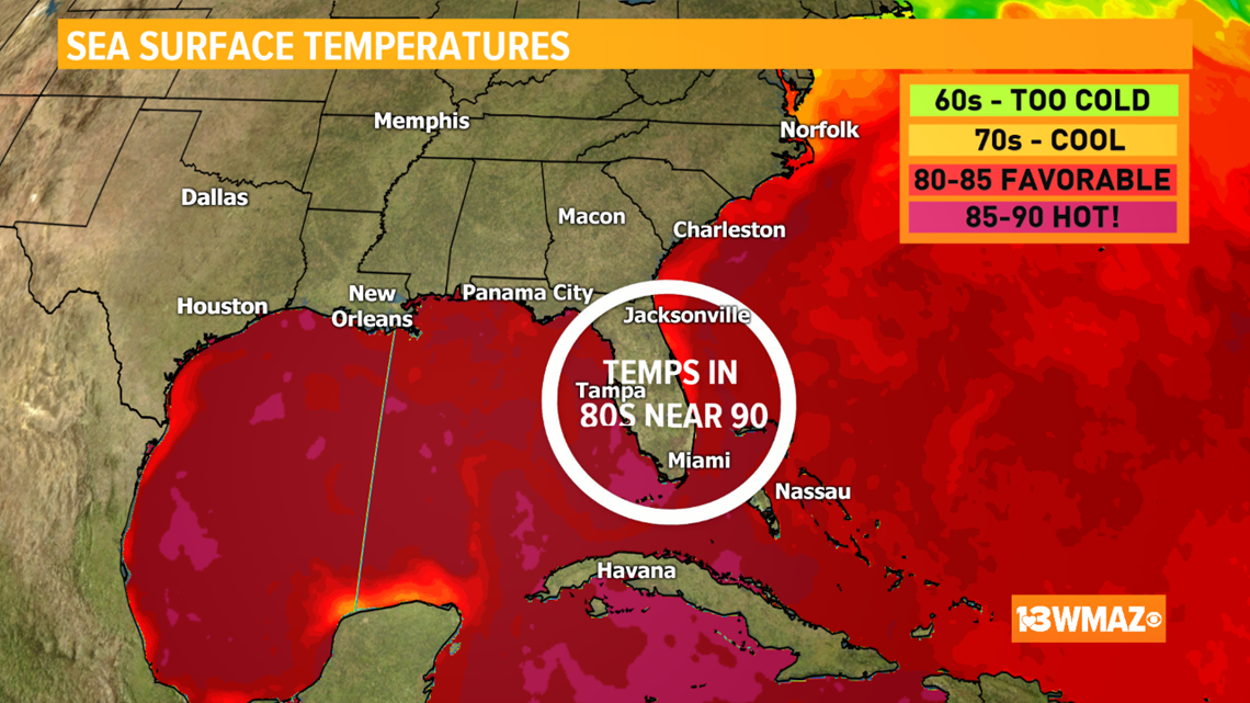
All you need to know is the warmer the water, the more heat to be released, leading to more fuel for a storm.
The ocean is extremely warm, so there's definitely no lack of fuel.


However, by mid-week, Dorian will get close to Hispaniola. The question is, how direct will the hit be?
The latest forecast cone shows the potential for a direct pass, and if that occurs, the storm will have a large fight to overcome.


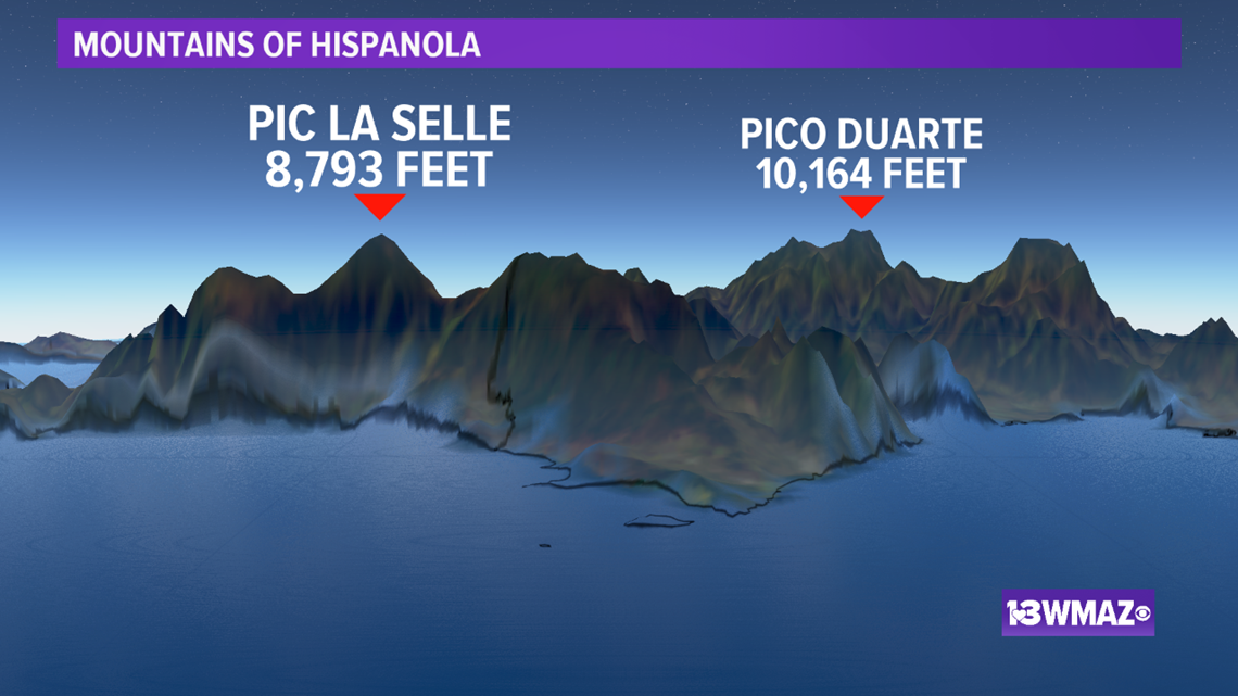
Land already cuts off a tropical system's life supply, but when you add mountains upwards of 10,000 feet, this introduces lots of friction.


This friction aids in tearing apart the storm and breaking up the center. The less organized the center is, the more the storm will weaken.
There is still a lot of uncertainty considering once it passes by Hispaniola, it again enters into very warm water and heads towards the very small and sparse islands in the Bahamas.
Be sure to stay tuned to 13WMAZ for the latest forecast updates on Dorian.

