Hurricane Barry made landfall last weekend as a Category 1 hurricane in Louisiana as the first hurricane of the 2019 Atlantic Hurricane Season.
It also may very well be the last named storm for a few weeks.
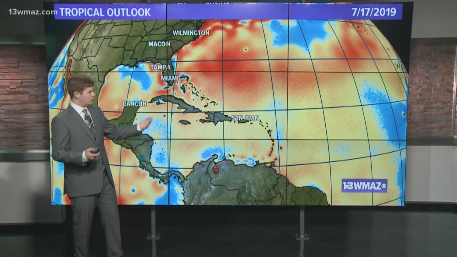
First, let's look at the Gulf of Mexico. Like most tropical systems, Barry pulled up cooler waters as it traveled towards the coast.
In the map, blue water represents cooler than normal sea surface temperatures, while red represents warmer than normal sea surface temperatures.
Tropical systems need very warm water of about 80 degrees Fahrenheit or warmer to develop. With a cooler gulf, it's less likely that we will see another storm develop close to home.


Across the rest of the Atlantic, sea surface temperatures are heating up and becoming more supportive of tropical development.
However, there is a limiting factor: dry air. Tropical systems need moist air to develop. The map shows all of the dry air located over the Atlantic.


The mid-level dry air essentially chokes off fuel to any storms that try to develop and organize. We'll have to watch over the next few weeks to see how this changes, but for the time being, the Atlantic looks to stay quiet.

