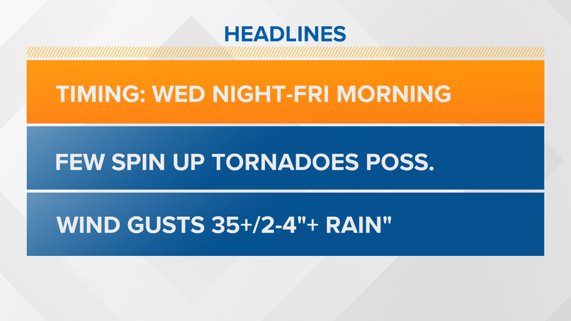
As of the Tuesday 11 a.m. update from the National Hurricane Center, the storm maintains its status as a category 1 hurricane. The outermost rain bands of Sally will bring a chance for localized flooding and maybe a few brief, spin up tornadoes as we head into Wednesday night through Thursday.
Models are still not in agreement on timing, so we still could be dealing with tropical downpours into Friday. Rainfall totals over two inches through the weekend are looking more likely, but we could see numbers go much higher than that. Central Georgia may also face an isolated tornado threat this week. Here is what you need to know.
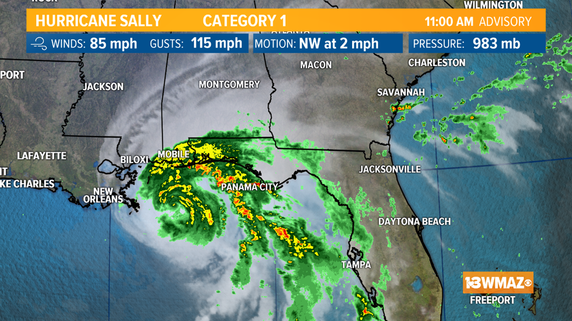
WHAT THE STORM IS DOING NOW: Sally is now a category one hurricane as of this morning with sustained winds of 85 mph.
The central pressure did drop a touch since the last update, but Sally is not forecast to restrengthen to a category 2 storm before landfall.

OFFICIAL NATIONAL HURRICANE CENTER FORECAST: The system made a turn to the northwest as of the 11 am advisory, and will make the turn to the northeast by the overnight hours Thursday.

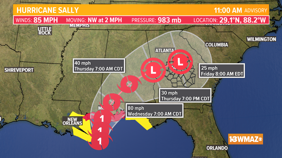
While there is still a good bit of uncertainty in where the exact center of circulation will track, the northeastward motion will bring much of the southeast heavy rainfall.
Due to the uncertainty with the models, we could see the most rainfall, wind, and isolated tornado threat from Sally any time from Wednesday to Friday. The system will be slow to move out, but should finally exit the region by Friday or Saturday, then a cold front will be the culprit for our breezy conditions to end the week and start the weekend.
POTENTIAL CENTRAL GEORGIA IMPACTS: The two main impacts that central Georgia may see from this system are heavy rain and the potential for isolated tornadoes.
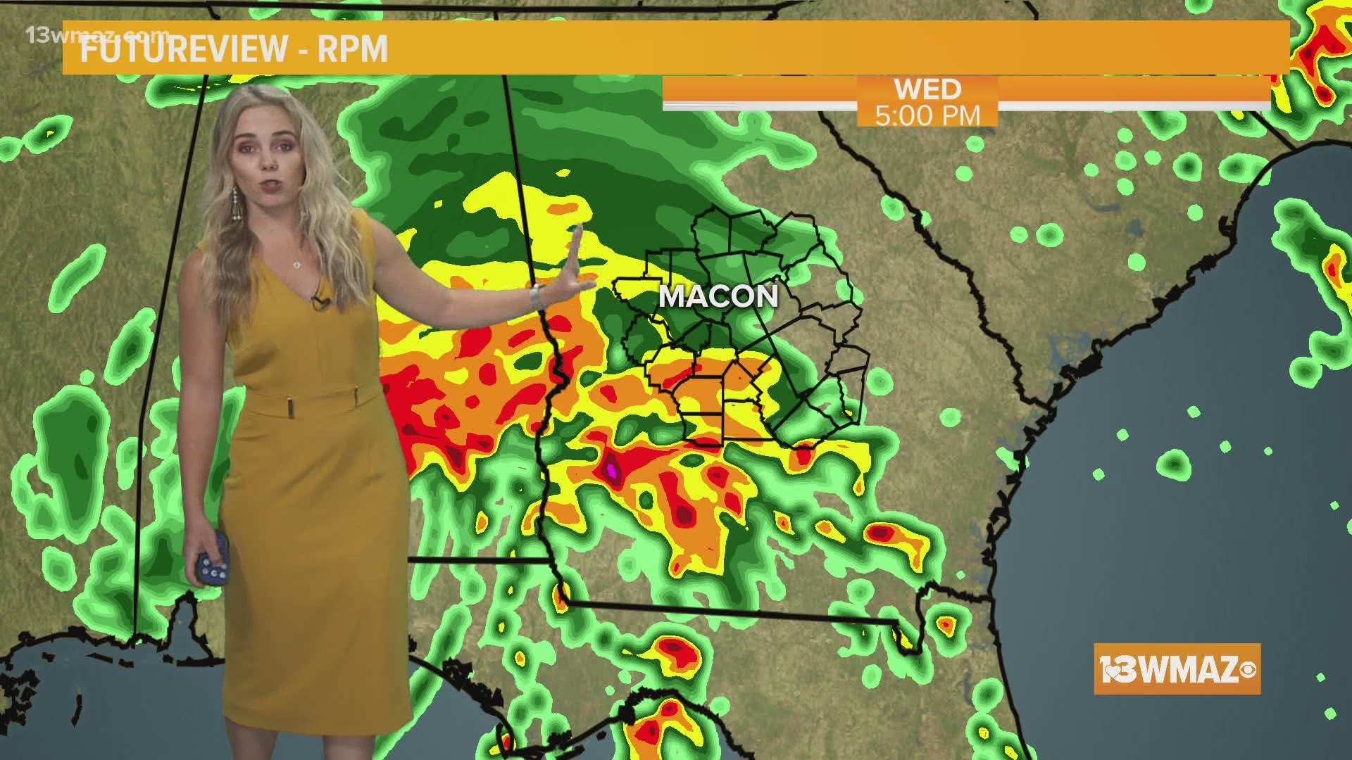
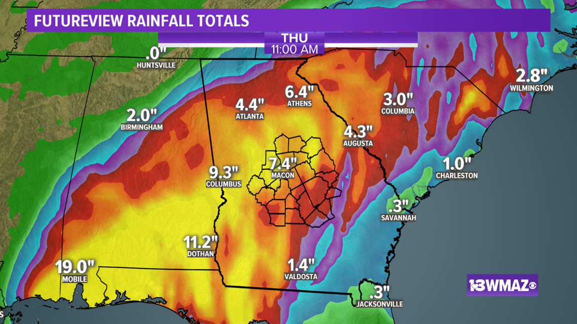
Forecasted rainfall totals vary depending on which model you choose. For instance, the RPM model shows a lot of rain for us coming through Wednesday.

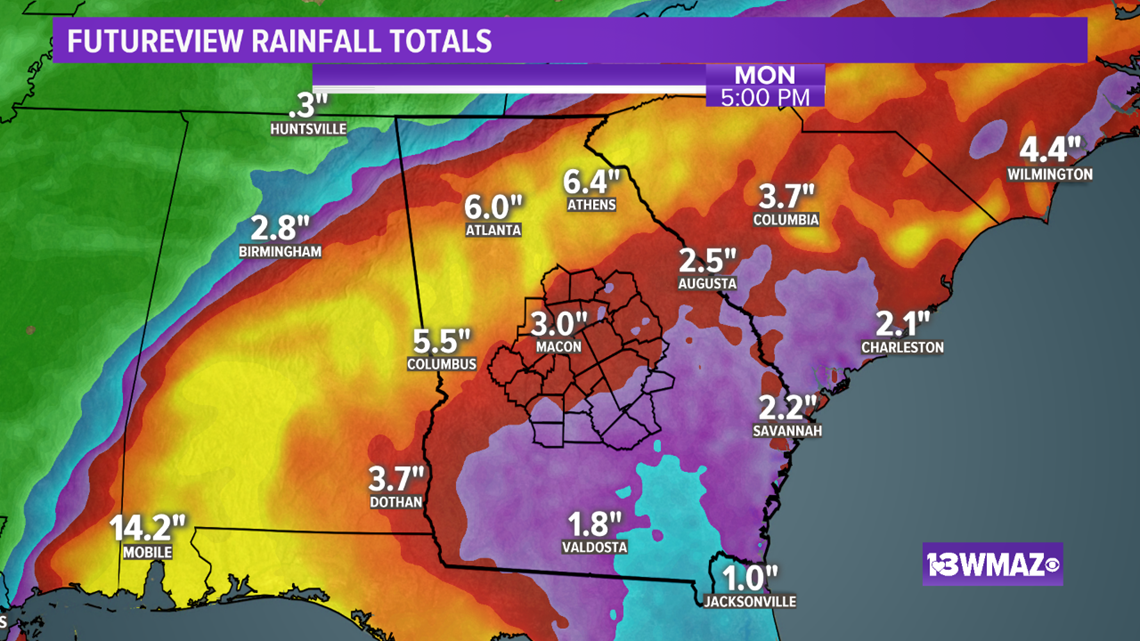
When you look at the EURO model, most of the rain goes to north Georgia, and not until around Friday.

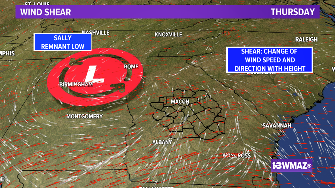
Severe weather chances cannot be completely ruled out, especially during the Wednesday - Friday time frame. Isolated tornadoes are possible with any land falling tropical system. As the remnant low passes near or over central Georgia, there could be enough wind shear to support a few isolated tornadoes.
The red and white arrows on the map below indicate the different speed and direction of wind at different layers in the atmosphere. This twisting and turning is what leads to the isolated tornado risk with land falling tropical systems. We'll evaluate this threat carefully as we go through the week.

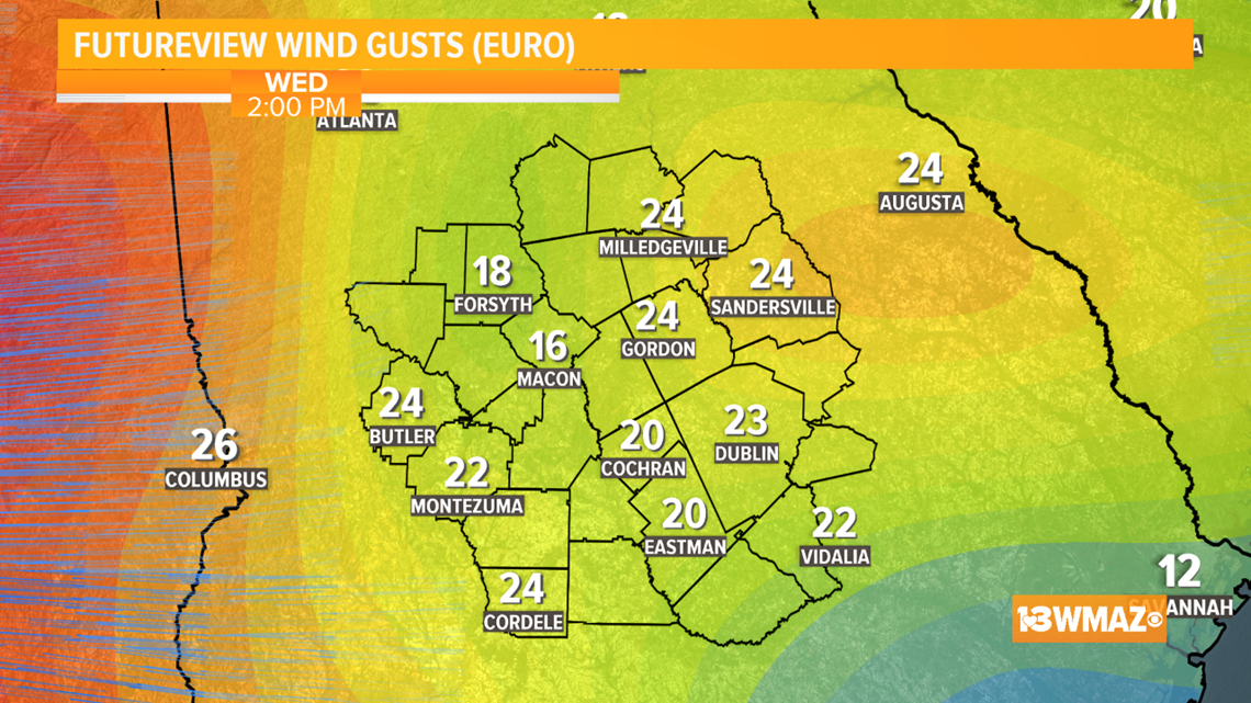
Significant wind gusts are not likely as the remnant low passes by. We could see gusts in the 20-30MPH range this week starting Wednesday, with isolated gusts as high as 40mph.

KEY MESSAGES: Central Georgia will see increased rain chances this week due to Sally. There is the potential, like with any land falling tropical system, for isolated tornadoes. As the remnant low passes by Wednesday - Friday, we'll keep a close eye on that threat. While heavy rain is likely, central Georgia should avoid the intense tropical rains that folks along the Gulf coast will experience.

