
An Ice Storm Warning remains in effect for much of Central Georgia this morning.
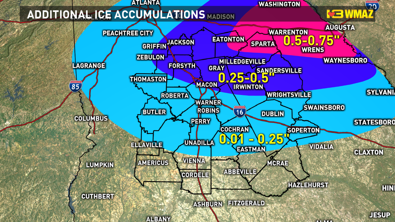
The southernmost part of the warning area, including Macon and Warner Robins, could get a tenth- to a quarter-inch of ice.
But further north, toward Eatonton and the I-20 corridor, more crippling effects with over an inch of ice (storm total) are possible.
We'll see a temporary break from the heavier rain into this afternoon. Steadier rain should fill back in this evening. Temperatures will remain near freezing, and much of the ice will accumulate on elevated surfaces. Winds could still gust to 20-25 mph...so additional downed trees are possible. As temperatures drop (and stay) below freezing tonight, more icy spots on area roads are possible. Ice amounts will vary greatly across Middle Georgia. Additional accumulations for Macon and Warner Robins shouldn't total more than 0.1 - 0.25". Higher totals to the northeast of Macon.

There might be light snow late tonight and early Thursday morning before the storm moves out.