

MACON, Ga. — The tropics look like they are starting to wake up this week!
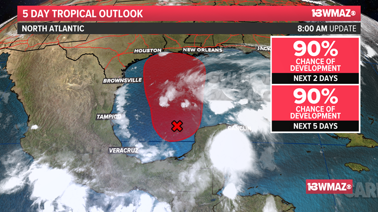
Tropical Storm Bill formed in the Atlantic, has weakened, and poses no threat to the United States, but a disturbance near the Bay of Campeche looks to be a different story.
As of now, the disturbance we're tracking has a 90% chance of development over the next two days.
It is likely we will have Tropical Depression 3 by the end of the week, but there is the possibility it could strengthen further to become Tropical Storm Claudette before moving inland along the Gulf Coast some time this weekend.
Here at home, models are coming into better agreement, but there are still some pieces of the puzzle to put together.
TIMING: Come Saturday morning, the tropical system (either a depression or tropical storm at this point) will move inland somewhere along the Louisiana coast. On Saturday, a few of the outer rain bands carrying rain and storms will roll in from south to north through Central Georgia starting in the afternoon.
Sunday morning/early afternoon: The center of the system (intensity to be determined) will be tracking just off to our northwest. This is when we will have the best potential for some heavier tropical downpours and really pick up the wind.
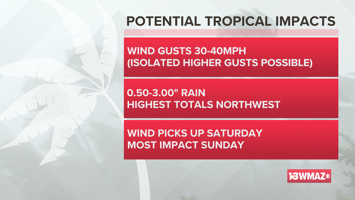
POTENTIAL IMPACTS: When it comes to any landfalling tropical system, we will be most concerned for wind and rain. We will also be on the right side, which means we can't completely rule out a brief spin-up tornado.
Wind gusts between 25-40 mph will be possible with isolated higher gusts possible for Sunday morning into early Monday.

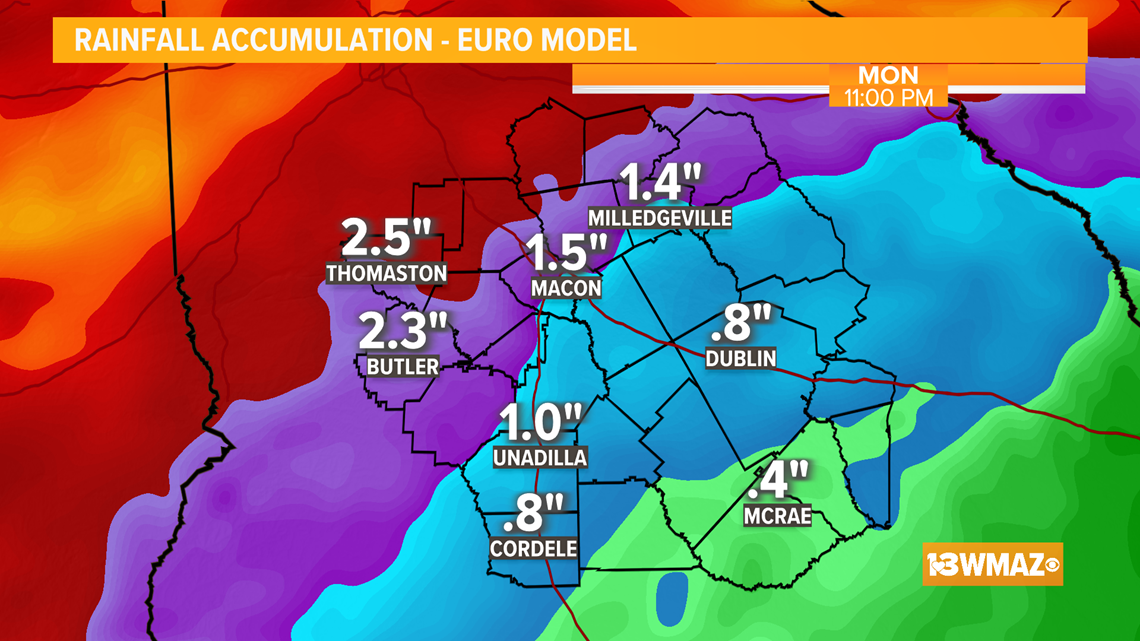
When it comes to rainfall totals, the GFS is a little more aggressive than the EURO as the GFS brings the center of circulation a little closer to Central Georgia -- bringing heavier downpours with it.

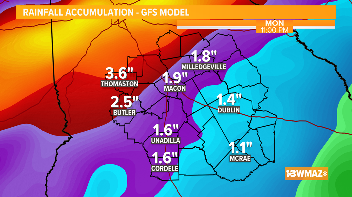
For now, we will say expect anywhere between 0.5" - 3" of rain, with locally heavy amounts north and west of Macon.

The 13WMAZ Weather Team will continue to keep you updated on-air and online as new information becomes available.
RELATED HEADLINES
STAY ALERT | Download our FREE app now to receive breaking news and weather alerts. You can find the app on the Apple Store and Google Play.
STAY UPDATED | Click here to subscribe to our Midday Minute newsletter and receive the latest headlines and information in your inbox every day.
Have a news tip? Email news@13wmaz.com, or visit our Facebook page.