
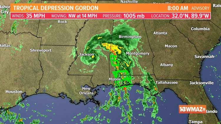
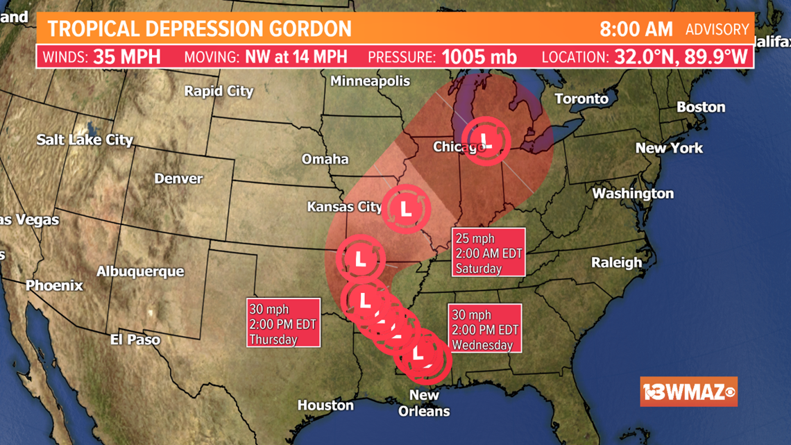
After making landfall Tuesday night as a tropical storm, Gordon is now moving inland through Mississippi and has weakened into a tropical depression. Tropical Depression Gordon has maximum sustained winds of 35 mph and is moving to the NW at 14 mph.
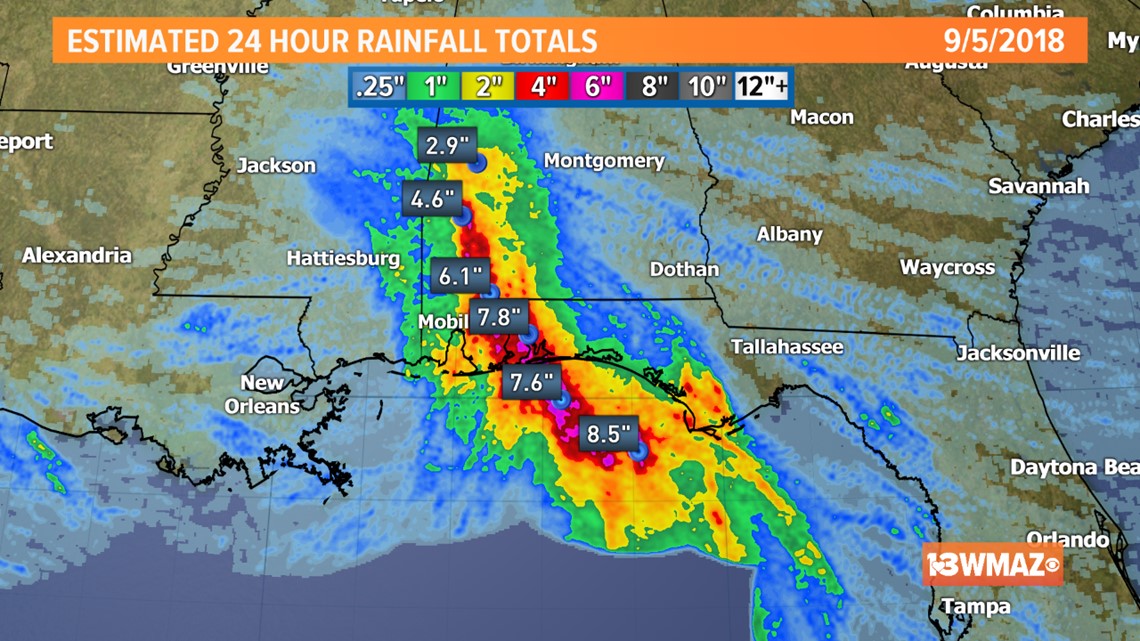
Gordon has already dumped several inches of rain across parts of Alabama and Florida where flash flood warning have been posted. Isolated amounts approaching 8 inches have already been observed.
Gordon will continue to produce heavy rain as it weakens and moves to the northwest. Gordon will eventually get caught up in the overall steering pattern and veer to the northeast by the weekend. Gordon will have no noticeable impact on the local forecast for central Georgia.
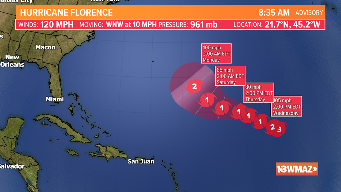
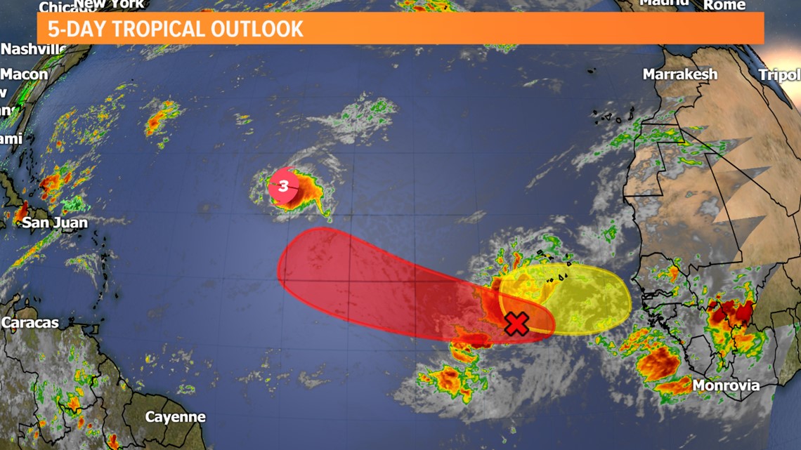
As Gordon weakens, the overall tropical pattern remain active in the Atlantic where Hurricane Florence is now a category 3 hurricane. Florence is the first major hurricane of the 2018 Atlantic hurricane season.


The latest forecast from the NHC suggests there is a high likelihood that Florence recurves before hitting the continental United States. However, some computer model guidance suggest Florence could bend back towards the US. It's still too early to make a call on Florence, but at this time Florence is not an immediate threat to Georgia or the continental United States.

Behind Florence two tropical waves have a chance to develop into named storms over the next 5 days over the open Atlantic. The next named storm will be called Helene.
The climatological peak of hurricane season is September 10th so be sure to stay tuned to 13 WMAZ for frequent updates on the tropics.